


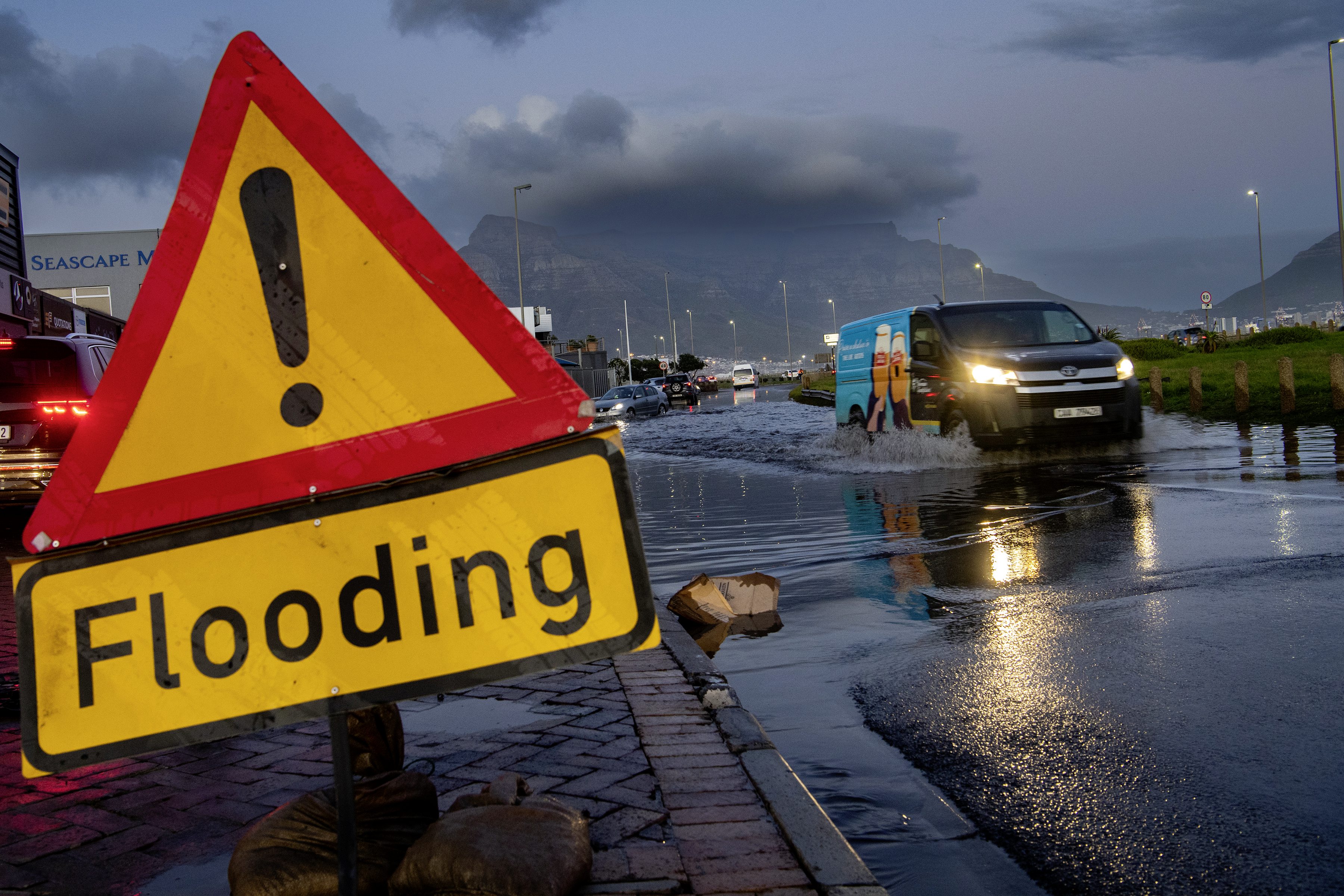
 Motorists negotiate a flooded Milner Road in Paarden Eiland, Cape Town, on 12 June 2023. (Photo: Gallo images / Gie Burger / Jaco Marais)
 A cold front will move into the southwestern Cape from Monday, 4 August, bringing cold, wet and windy weather to the Western Cape and parts of the Northern Cape. Daytime temperatures are expected to drop to 10°C or below, with winds reaching about 30km/h.
By Wednesday these chilly and unsettled conditions are likely to spread inland, affecting areas including the Namakwa District in the Northern Cape and parts of the Witzenberg Municipality in the Western Cape.
Satellite animation for today, 3 August 2025.#saws #weatheroutlook #southafricanweather pic.twitter.com/wl6Gkr21rN
— SA Weather Service (@SAWeatherService) August 3, 2025
The South African Weather Service (SAWS) advised the public, particularly small-stock farmers, to take precautions to protect themselves and their animals against the cold, wet and windy conditions.
On Tuesday, very cold conditions are forecast for much of the Western Cape and the southern Northern Cape, moving into the Eastern Cape. Isolated to scattered showers are expected as the system shifts eastwards.
“On Monday and Tuesday, scattered to widespread showers are likely in parts of the Cape provinces,” Vox Weather meteorologist Michelle du Plessis told Daily Maverick.
What is a cold front?
Vox Meteorologist Michelle du Plessis explained that cold fronts are part of a larger weather system called a mid-latitude cyclone.
A cold front is the leading edge of a mass of cold, dense air that pushes into an area of warmer, lighter air. As the cold air moves in, it forces the warm air to rise quickly. This rising warm air cools, which often leads to the formation of clouds, rain, thunderstorms or even snow, depending on how cold it is.
Strong winds and seas
The weather service has issued Yellow level 1 warnings – which means a medium likelihood and a minor impact – for both damaging interior winds and damaging waves, with impacts expected from Monday into Wednesday.
“Possible damaging interior winds [are expected] over the Northern Cape today, and damaging waves along the west and south coast into tomorrow, which may result in difficulty in navigation at sea,” said SAWS meteorologist and weather forecaster Lehlohonolo Thobela.
/file/dailymaverick/wp-content/uploads/2025/08/WhatsApp-Image-2025-08-04-at-12.16.49.jpeg "(Graphic: Weathersa)")
Weather warning: Monday
The weather service has issued a Yellow level 1 warning for damaging winds in the Western Cape and Namakwa on Monday.
Strong northerly to northwesterly winds (40km/h to 50km/h, gusting 70km/h to 90km/h) over the southern interior of Namakwa (Northern Cape) and over the Central Karoo district from the morning into the evening can be expected.
These winds are owing to a cold front that is expected to make landfall over the southwestern parts of the Western Cape on Monday morning, with a cut-off low further southwest of the country.
Impacts include:
- Damage to formal/informal settlements and some structural damage is possible;
- Longer travel times are expected due to localised problems for high-sided vehicles;
- Localised power and communication interruptions may occur; and
- Risk of localised runaway fires.
Weather warning: Tuesday
There is also a Yellow level 1 warning for damaging waves from Monday until Wednesday on the west and south coasts of South Africa.
SAWS has warned of heavy southwesterly swells between 4m and 5m along the coast from Saldanha Bay to Cape Agulhas, starting on Monday evening. These swells will spread to other coastal areas, including Alexander Bay and Plettenberg Bay, by Tuesday.
The waves are coming in at intervals of about 15 seconds, meaning powerful waves will regularly hit the shore. These conditions are expected to disrupt beachfront activities and could be dangerous for people near the water, such as those on rocks, who risk being swept into the sea.
What to know if you’re travelling
“A cold front is expected to make landfall over the southwestern parts of the country, resulting in isolated to scattered rain over the Western Cape, with damaging winds expected over the interior of the Northern Cape,” said Thobela.
The possible impacts included runaway fires, travel disruptions, especially for high-profile vehicles, and difficult navigation at sea.
“If you are on the road today, be on the lookout,” he added.
Cut-off low to bring snow and thunderstorms
Following the cold front, Du Plessis said a steep upper-air trough will develop into a cut-off low-pressure system by early Wednesday.
“The cut-off low will move over central SA, dropping freezing levels low enough for some snow in the Northern Cape, Free State, Eastern Cape and Lesotho, with snow as far north likely as in parts of North West.”
Forecasters were expecting rain in the regions where snow was forecast. “So the snow might quickly melt or rather fall in the form of sleet or freezing rain as well.”
By Tuesday and Wednesday the system was expected to bring cold weather, a band of showers and thunderstorms to central parts of the country – including North West, the eastern Northern Cape, the Free State, Eastern Cape and KwaZulu-Natal – before spreading eastwards on Thursday, bringing cold weather to Gauteng, the Highveld and Limpopo.
“By Thursday, the cold weather will also spread into Gauteng and surrounding regions where temperatures will be below 15°C.”
SAWS confirmed that on Thursday isolated to scattered rain and showers are expected over the northeastern parts of the country, covering Gauteng, KwaZulu-Natal, Mpumalanga and Limpopo.
Is this normal?
Du Plessis said it’s completely normal to see cold fronts and cut-off lows at this time of year.
“However, snow reaching as far north as currently forecast is more unusual,” she noted.
“As we always say, this is an advanced forecast, and cut-off lows are notoriously unpredictable – the forecast can easily change from one day to the next. Plus, if the snow falls with rain, it can melt quickly or not reach the ground as snow at all.
Thobela added: “Cold fronts are much more common in winter, and in August we are still expecting more of the several cold fronts to make landfall over southern parts of the country.” DM