


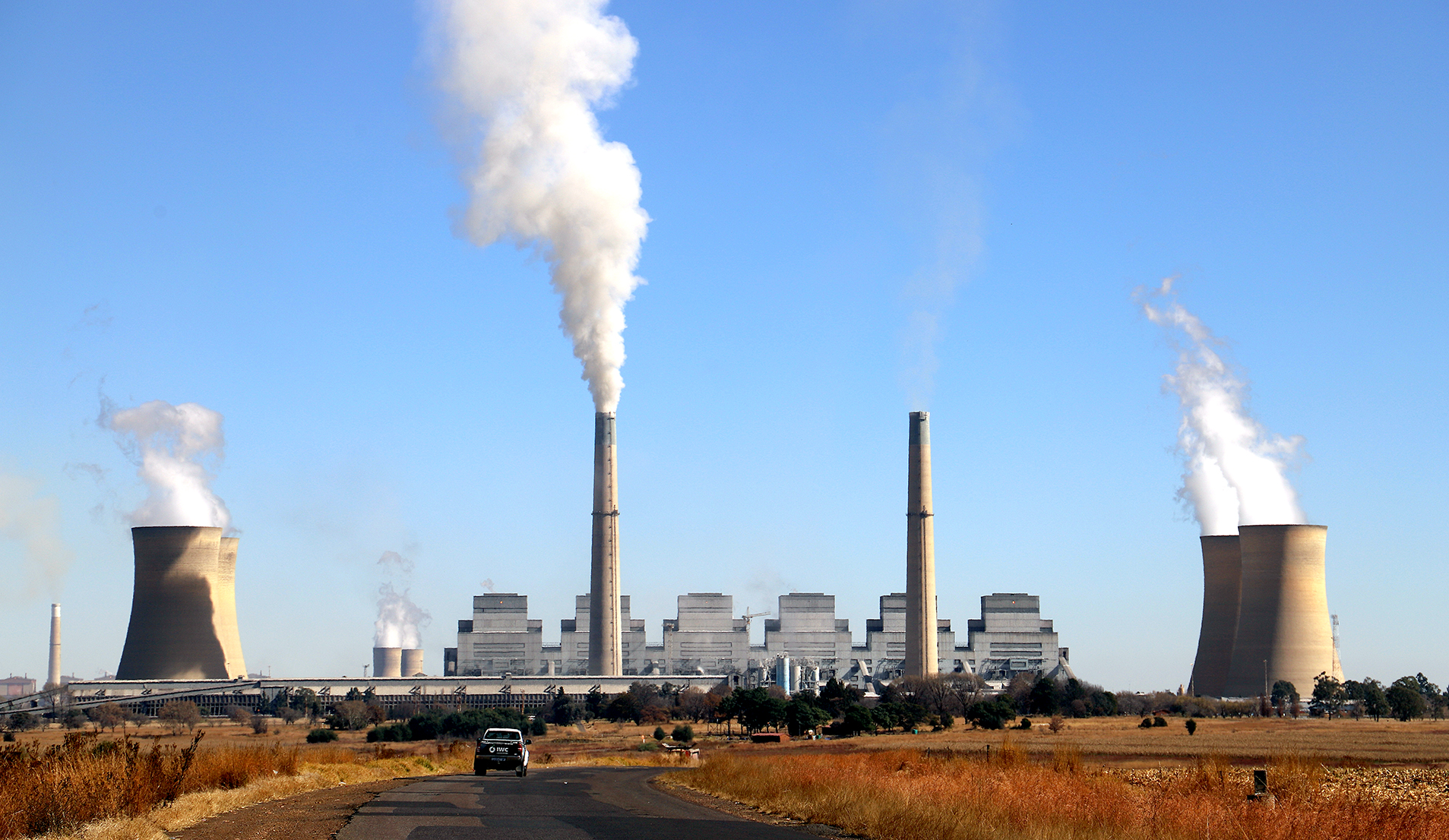
 Kriel Power Station in the foreground and Matla Power Station behind, near Thubelihle in Mpumalanga, (Photo: Ethan van Diemen)
 South Africa’s reliance on coal-fired power stations has long fuelled economic growth, but it also exacts a heavy toll on the environment and public health.
To uncover where pollution is most severe and which communities are bearing the brunt, we turned to geojournalism: combining environmental data with Geographic Information Systems (GIS) tools to visualise and analyse complex interactions on a map.
Read more: Pinpointing Pollution (Part 1) — The Mpumalanga town where South Africans suffer most
Read more: Pinpointing Pollution (Part 2): Living and dying in Thubelihle
Mapping the data
We layered six key datasets over satellite imagery of South Africa to see how pollution overlaps with population, schools, and healthcare access:
- Coal-fired power station locations – Eskom
- Active coal mine locations – Global Energy Monitor
- Annual particulate matter (PM2.5) pollution levels – Copernicus & Nasa
- Population density per ward – Copernicus
- School locations – Esri Geoportal Africa
- Clinics and hospital locations – Esri Geoportal Africa
Each layer was carefully prepared and integrated using GIS software to ensure alignment and accuracy.
Finding the pollution hotspots
Focusing on Mpumalanga, home to many coal plants, we performed a hotspot analysis to identify clusters of significantly high pollution levels within 30km of power stations.
/file/dailymaverick/wp-content/uploads/2025/07/DJI_0997-2.jpg "An aerial view over a part of Thubelihle, near Kriel in Mpumalanga, showing a large mine is just across the street from the community. (Photo: Ethan van Diemen)")
/file/dailymaverick/wp-content/uploads/2025/07/IMG_1241-2.jpg "The air in Thubelihle carries a constant yellow/ochre-tinted haze due in no small part to the Kriel Power Station and other industries in the area. Despite that, life continues and children play in the street like in any other South African town. (Photo: Ethan van Diemen)")
This analysis revealed that the region between the Kriel and Matla coal-fired power stations stands out as the most polluted area in South Africa. Additional smaller hotspots around other plants, like Lethabo, were noted but were less intense.
Pollution meets population and public services
Overlaying population density data showed that a significant number of residents live within the pollution hotspot. Multiple schools are located in this area, including some in close proximity to power plants.
Access to healthcare in this region is limited; residents typically have to travel several kilometres to reach clinics, and hospitals are located even further away, leaving communities particularly vulnerable.
/file/dailymaverick/wp-content/uploads/2025/07/IMG_1111-2.jpg "The only healthcare facility in the Thubelihle area. Most people cannot afford to spend money on transport to get to further-flung clinics and hospitals, nor can they afford the cost of care. (Photo: Ethan van Diemen)")
Thubelihle stands out as one of the worst-affected communities because it is densely populated and lies very close to the Kriel power station, which has some of the highest measured particulate matter pollution levels. Moreover, Thubelihle has limited healthcare infrastructure, forcing residents to travel long distances for hospital care. Combined with the presence of schools nearby, this makes the community especially exposed to the harmful effects of coal pollution.
Eskom’s emission challenges
Our findings echo concerns raised recently in Parliament. Eskom itself acknowledged that the Kriel power station fails to meet minimum emission standards for particulate matter, highlighting the health risks faced by communities nearby.
However, pollution here is not solely from Eskom’s operations. Coal mining activities, heavy transport and household coal burning also contribute significantly to air quality issues in the region.
Why this matters
By combining environmental data, population statistics and locations of critical infrastructure, geojournalism paints a vivid picture of who is most affected by South Africa’s coal pollution crisis. Children attending schools near power plants, communities far from healthcare and densely populated wards all intersect in this hotspot, underscoring urgent needs for policy action and environmental justice.
DM