


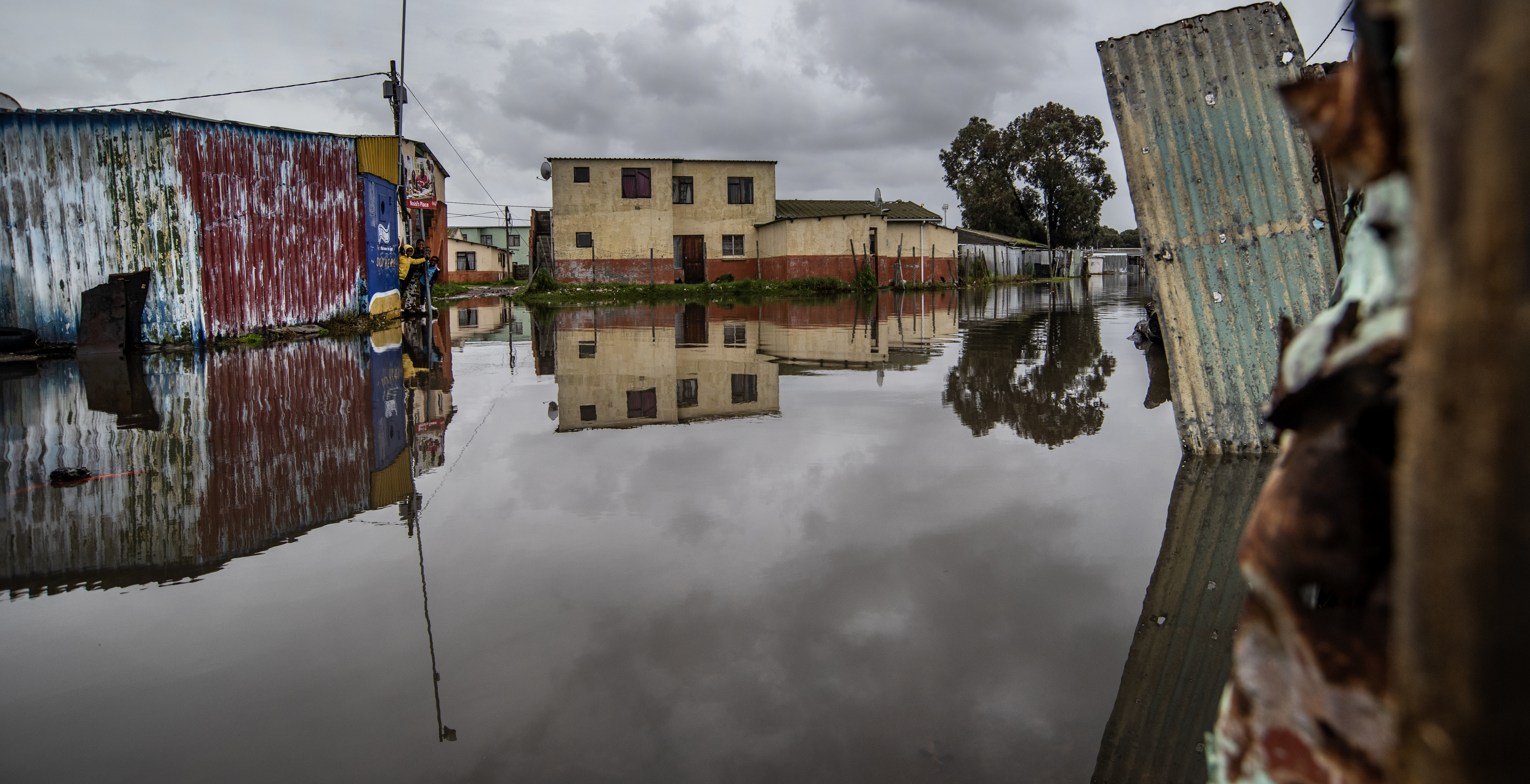
 Recent heavy rains caused flooding in Nyanga, Cape Town. (Photo: Brenton Geach)
 If you live in the Western Cape and think this year has been especially wet, you’d be right. It’s the highest rainfall the province has had since 1976 – that’s 47 years.
“If we aggregate the rainfall we’ve had so far… if we say the total rainfall by the 21st of June – this year is the highest we’ve had since 1976. So that is [the most rainfall in a year up until 21 June in] 47 years,” says Dr Peter Johnston, a Research Officer at the University of Cape Town’s Climate System Analysis Group (CSAG).
And Dr Piotr Wolski, chief research officer for hydroclimatology at CSAG, told Daily Maverick that “if we look at total rainfall between January and now… at some locations, this year’s values are the highest on the recent record (we are looking at 20-40 years of data here)”.
The scientists were in discussion with Daily Maverick in the days following successive cold fronts and exceptionally rainy weather that battered parts of the Western Cape over the course of the month.
/file/dailymaverick/wp-content/uploads/2023/06/Ethan-WetWC47-3.jpg "Flooding in Worcester after heavy winter rains in the Western Cape on 15 June 2023. (Photo: Supplied)")
Daily Maverick has previously reported that heavy rainfall in the Western Cape between 14 and 19 June claimed the lives of two people and left thousands displaced, as authorities and aid workers continued with relief efforts. Moreover, according to initial assessments, the flood damage is expected to cost the province’s agricultural sector between R750-million and R1-billion.
Read more in Daily Maverick: Heavy Western Cape rains claim two lives, leave thousands displaced while relief efforts continue
Western Cape Local Government, Environmental Affairs and Development Planning MEC Anton Bredell has said the province is characterised by a highly variable weather and climate regime. This means it has always, and will in future, experience all manner of extreme weather and climatic events including flooding, drought and extreme temperature.
“The Western Cape is the most disaster-prone province in South Africa, and is particularly vulnerable to climate change and the effects of climate-related hazards because of its coastal location, with rising sea temperatures expected to influence regional weather patterns,” he said.
Studies have found that between 1900 and 2018, at least 334 major flood events occurred in the Western Cape, with roughly three events occurring in any given year. However, this varies – in 2008, the province experienced 20 floods, and 15 in 1981, Bredell noted.
He said statistically, it appears that in recent years there has been a trend towards more flood events per year.
Flooding has also been identified in the Western Cape Climate Change Response Strategy: Vision 2050 and its Implementation Plan as one of the many areas of concern.
The Western Cape government expects that the natural variability in the weather patterns of the Western Cape is likely to intensify because of climate change, bringing both flooding and droughts.
“Over the past 10 years, the province has experienced several severe flood events, including the Garden Route (then Eden) floods in 2011, 2012 and 2013; the Overberg floods in 2013 and 2021; Central Karoo floods in 2014; and Cape Winelands floods in 2013 and 2014,” Bredell said.
The climate change response for the province looks to the disaster management and infrastructure sectors, as well as municipalities, as implementation agents with regard to flood preparedness and response.
Bredell said it is not so much the overarching climate change response plan that deals with flood preparedness and response, but the development planning, risk mitigation and disaster response planning of these sectors.
/file/dailymaverick/wp-content/uploads/2023/06/homes-0150.jpg "The informal settlement of Mnyamandawo in Citrusdal after the Olifants River burst its banks, washing away homes and leaving many people homeless. (Photo: Brenton Geach)")
“Some of the mitigation strategies that should be looked at following the recent floods include improving mechanisms to get an early warning to at-risk communities; improving flood awareness at the community level; and enhancing emergency response capabilities,” he said.
While relief efforts persist and the province counts the cost of the deluge, Daily Maverick sought to find out just how anomalous this year’s rainfall and flooding are and what role – if any – human-induced climate change played in it.
UCT’s Dr Johnston, in a call with Daily Maverick, said of the levels of rainfall: “It is considerably higher than it has been in a while but there are two aspects to it.
“The first one is that we had a lot of rain pre-winter. March rainfall was a record rainfall. I don’t think we’ve had many years of it being that high when it comes to winter if we aggregate the rainfall we’ve had so far, if we say the total rainfall by the 21st of June. This year is the highest we’ve had since 1976. So that is 47 years. It’s the highest rainfall we’ve had up to this point in a year since 1976.
“So it certainly is anomalous, if you like, but I’d hate to say it’s extreme because the variation in rainfall is very high, and if you look at the graphs, it’s not that much higher than previous years. It’s not double that of previous years… it is just higher than previous years.
“It’s not completely abnormal, because the rainfall in June, even though it has been quite high so far, is not the highest rainfall we’ve ever had in June, but the accumulated rainfall up to this point is the highest we’ve had in 47 years.”
Asked why this is, Johnston said: “The simple answer is that the climatological systems have aligned themselves very well to give us this very wet winter.
“We’ve got a higher frequency of cold fronts coming past… we’ve got the lesser impact of the high-pressure cell that seems to have shrunk away, and we don’t understand exactly what brings these about.
“We do know that there is a randomness in the atmosphere which causes variation every year… no two years are exactly the same.
/file/dailymaverick/wp-content/uploads/2023/06/Ethan-WetWC47-5.jpg "Flooding in Retreat, Cape Town on 19 June 2023. (Photo: Gallo Images / ER Lombard)")
“So we can’t ascribe it to climate change as such. The climate change scenarios are generally saying that the rainfall will probably stay the same or get less. But we can say that we’ve got a more energetic atmosphere because of global warming and that energetic atmosphere does produce higher rainfall episodes.
“Now, we’re not saying this is a pattern going into the future, but we are saying that global warming all over the world has been leading to higher and heavier rainfall.”
Read more in Daily Maverick: Weather experts issue alert over looming El Niño as sea surface temperatures hit record highs
UCT’s Dr Wolski told Daily Maverick: “If we look at total rainfall between January and now… first, at some locations, this year’s values are the highest on the recent record (we are looking at 20-40 years of data here).
“Second, that level of ‘wetness’ would statistically occur as rarely as once in 30 (as in Steenbras) to once in 140 years (as in eg Wemmershoek). There are locations where anomalies are very strong – eg Newlands and Theewaterskloof.
“Those very high values are rather suspicious, perhaps unrealistic and have to be taken with a pinch of salt, as it is possible that they reflect some problems with data rather than a real amount of rainfall those locations received.
“Still, even if we pull out big statistical guns and derive values that we can be more sure about, then we could be 95% confident that this year is at least as rare as one in 20 to one in 100 years.”
Asked what role, if any, human-induced or anthropogenic climate change played in the downpours, Wolski explained that “our current understanding of the role of climate change in the winter rainfall region is that its predominant influence is towards making that region drier, with an increase in probabilities and severity of droughts such as the ‘Day Zero’ one.
“To my knowledge, we have not seen any convincing evidence towards an increase in the intensity of individual extreme rainfall events in the region and even less evidence of an increase in frequency or wetness of wet winters.
“Importantly, what we see now is not a single extreme event, but rather a sequence of rather high rainfall events (yes, some of them extreme) that make the winter (entire winter, but in particular the early June) unusually wet,” he continued.
/file/dailymaverick/wp-content/uploads/2023/06/Ethan-WetWC47-2.jpg "The turnoff from Raapenberg Road in Mowbray flooded after heavy rain on 14 June 2023. (Photo: Supplied)")
“This is important because through physics we know that anthropogenic climate change may manifest through an increase in extremely high rainfall at the same locations where we observe an increase in droughts or overall drying.
“But that reasoning cannot be translated to what we see in Cape Town this winter. To sum up – at first sight, this winter, although extreme, does not seem to be related to anthropogenic climate change. But dedicated analyses are needed to be more sure about this statement.”
Read more in Daily Maverick: The city that blows hot and cold – Cape Town’s flood-drought dichotomy explained
A team of expert climate modelling, adaptation and climate services researchers from the Agricultural Research Council (ARC) and the Council for Scientific and Industrial Research (CSIR) provided their inputs to Daily Maverick on the impacts that anthropogenic climate change had on the severity of the recent prolonged rainfall and flooding in the Western Cape. They expanded on Wolski’s analysis.
CSIR climate modelling senior researcher Mohau Mateyisi compiled this analysis with support from Shingi Nangombe (CSIR), Johan Malherbe (ARC), Bathobile Maseko (CSIR), Trevor Lumsden (CSIR), and Teke Ramotubei (CSIR).
The researchers said “the consensus with regard to climate change and the winter rainfall area is that rainfall in total is more likely to become less as cold fronts develop further south in a warming climate.
“The warming of temperatures, under climate change, stands a chance to amplify the water-holding capacity of air at a risk of more intense storms as a warmer atmosphere may hold more water vapour. This could increase the potential for higher rainfall totals during specific events.”
Mateyisi said, “The recent flooding events suggest a need for risk and vulnerability assessment research to inform scenario planning specifically looking at river channels, built infrastructure and land-use cases, eg dams, settlement and farming landscapes to bolster adaptation actions in the face of flood extremes based on the best available climate model evidence.”
The researchers said the most vulnerable populations are seasonal farm workers and people living in informal settlements.
Their access to impact-based forecasts issued by the South Africa Weather Service needs to be given special attention and extreme climate events evacuation routines need to be planned, rehearsed and actioned to optimise timely response to extreme events. DM
To read all about Daily Maverick’s recent The Gathering: Earth Edition, click here.
Comments
Scroll down to load comments...