


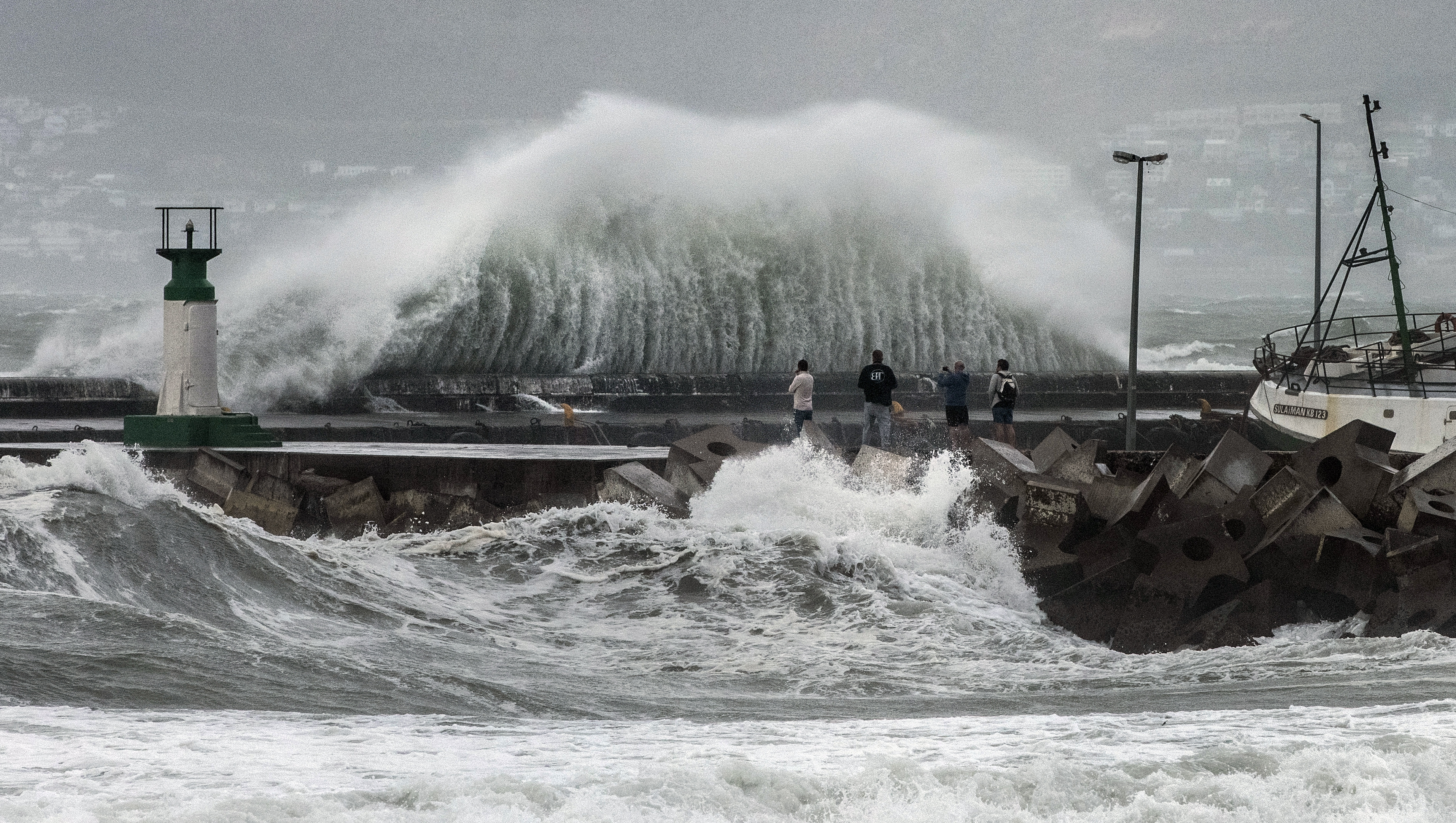
 Massive waves whipped up by strong winds at Kalk Bay Harbour in Cape Town on 7 April 2024. (Photo: Gallo Images / Brenton Geach)
 A cut-off low weather system has moved across South Africa, leaving in its wake heavy rain, strong winds and damaged infrastructure. On Monday, the South African Weather Service (Saws) issued several warnings of more severe weather.
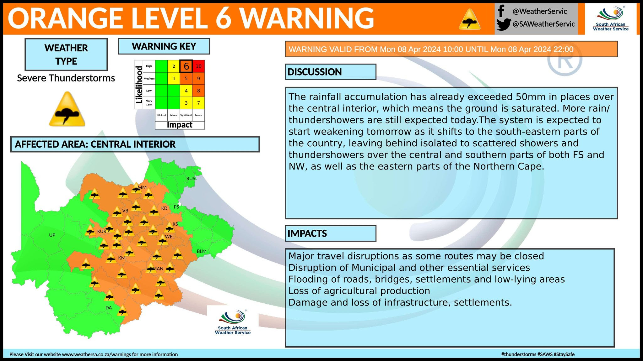
Some parts of South Africa’s central interior recorded more than 50mm of rain, which left the ground saturated and could cause flooding as more rain is expected.
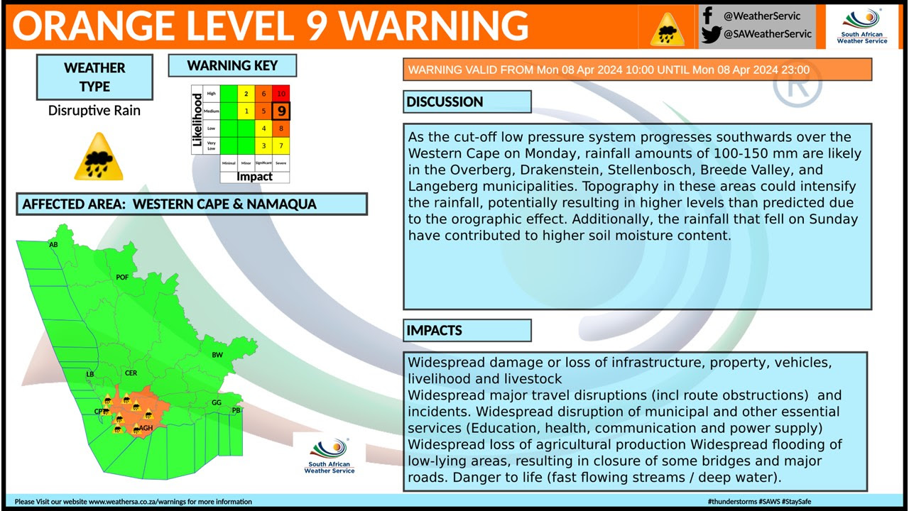
An Orange Level 9 warning of disruptive rain that could result in flooding was issued by Saws for much of the Western Cape, alongside a Level 6 warning for the central part of the province. A warning was also issued of strong waves exacerbated by strong winds that will result in difficulty in navigating seas, particularly between Saldanha Bay and Plettenberg Bay.
“We still have a cut-off low weather system that’s over the southwestern parts of the country situated around the southern parts of the Northern Cape province as well as the Western Cape,” said Saws forecaster Lehlohonolo Thobela.
“We are still expecting widespread showers and thundershowers for the central and southern parts of the country, with the Western Cape expected to have widespread showers [on Monday] as well as the central parts, which include the Free State, Eastern Cape and all the way up to North West, parts of KwaZulu-Natal and the southwestern part of Gauteng.”
Read more in Daily Maverick: ‘Better safe than sorry’ — hundreds of Western Cape schools remain closed over storms threat
An Orange Level 6 warning of severe thunderstorms was issued for the eastern parts of Northern Cape, central parts of North West, central Free State and the northwestern parts of Eastern Cape. The thunderstorms will bring about heavy rain that could result in flooding.
A Yellow Level 4 warning of disruptive rain was issued for the northeastern parts of Gauteng and Free State, as well as the eastern parts of North West. Damage to infrastructure, closure of bridges and some traffic disruptions were expected.
“[Extreme weather] is expected to last until Wednesday, especially over the south and eastern coasts of the country. On Wednesday we can start seeing improvements over the central and northern parts of the country, though remaining partly cloudy with cool temperatures but warm over the northern parts such as Limpopo.
“There will also be scattered showers of rain from the south to the east coast. On Thursday there’ll be a 30% chance of light showers and rain over the east coast,” Thobela said, adding that there would be less rain for the rest of the week after Wednesday.
Destruction
On Sunday, a fire fanned by strong winds linked to the cut-off low-pressure system destroyed and damaged houses in Sunny Cove, Fish Hoek, Daily Maverick reported.
On Saturday night, a fire burnt 250 structures in the Kayamandi informal settlement in Stellenbosch, displacing about 1,000 people. The strong winds contributed to the scale of destruction, according to a News24 report.
The strong winds damaged several wards at Mediclinic Stellenbosch and blew off a roof. The Huguenot Tunnel on the N1 was closed because of the strong winds. DM