
DOSSIER: BATTLEGROUND ANTARCTICA (PART ONE)
Using Cape Town as a launchpad, Russia boasts of supergiant oil fields in Antarctic wilderness
As Antarctic Treaty nations release the Paris Declaration, a new climate manifesto, Daily Maverick can reveal this international investigation: Russia has combed the fragile Southern Ocean for oil and gas on a staggering scale after Antarctica’s mining ban formally entered into force more than two decades ago.
A mammoth potential of 500 billion barrels in hydrocarbon “resources” — the building blocks for oil and gas — might be buried in supergiant oilfields beneath the Southern Ocean, the climate-threatened waters that wrap around Antarctica, according to Russian state entities.
Key points
- There are 500 billion barrels of Southern Ocean oil and gas, says Russian geological exploration holding company Rosgeo.
- These confounding claims were made from South Africa’s Table Bay harbour, used by Russia over decades to reach Antarctica.
- This week, treaty nations are considering marine protected areas in waters in which Russia does not appear to have stopped surveying for oil and gas since the mining ban entered into force in 1998.
- Despite restrictions, and outlawing activities such as prospecting and extraction, this ban may be changed from 2048.
Geology crews aboard the polar vessel Akademik Alexander Karpinsky announced these reserves in a communiqué issued by Rosgeo, the Russian Federation’s largest geological exploration holding company.
Claiming to have found “more than 1,000 fields and deposits, including major hydrocarbon and solid mineral deposits and fields” in other world regions, the state-owned exploration company published the announcement in English on its website as the Covid-19 pandemic swamped world headlines in February 2020.
Despite an Antarctic mining ban that does not expire but may be changed from 2048, the company’s suggestions of the Southern Ocean’s mineral resource largesse produced only isolated reports in market media – and a quiet “flurry” of raised eyebrows in some diplomatic and academic circles, as one analyst put it.
Diving into the Antarctic’s ‘oil and gas-bearing prospects’
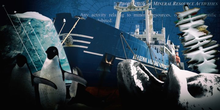
Equally confounding is the launch of the new Paris Declaration. That declaration, issued in June at the treaty’s 60th anniversary meeting, is designed to “implement actions consistent with” the Paris climate agreement. Yet, it appears that Russia’s oil and gas assessments never stopped after the ban, which outlaws “any activity relating to mineral resources, other than scientific research” in the general area below 60°S latitude.
Russia and other treaty countries, which include power players such as the US and Germany, may have a legal pre-ban record of resource exploration in the Antarctic Treaty area stretching as far back as the 1950s. Here, however, we can lay bare Russia’s post-1998 oil and gas nexus via Cape Town into Earth’s last unmined frontier – even as the Kremlin this month announced possible 2060 net-zero targets reliant on forests as carbon sponges, ahead of the landmark 2021 UN climate summit in Glasgow, Scotland.
And it is from the Port of Cape Town, historically prized not only for Table Mountain’s distinct silhouette, but also as a modern shipping and aerial gateway for major states with skin in the game below 60°S, that the polar vessel released her 500 billion-barrel bombshell statement.
The Rosgeo communiqué was issued with a headline leaving little doubt about the nature of the exploration company’s most recent operations, spearheaded in the Antarctic by its contracted subsidiary, the Polar Marine Geosurvey Expedition (PMGE): “Rosgeo has completed explorations of the geological structure and oil and gas potential of the Antarctic shelf.
“The geologists’ objective,” the exploration company emphasises, “was to explore the subsurface geological structure and to assess the oil and gas-bearing prospects of the Antarctic shelf.”
The communiqué also indicates the supergiant potential of “three large sedimentary basins” underneath the Southern Ocean, possibly holding “70 billion tons” in “hydrocarbon resources” — in other words, roughly 500 billion barrels of oil and gas equivalent.
Although this announcement did not say how much may be economically recoverable here, a supergiant field of recoverable hydrocarbons would be the largest of its class. For comparison, the world’s highest proved reserves for a single country belong to Venezuela at 300 billion barrels; and regional reserves to the Middle East at 830 billion barrels.
If 1% of the exploration company’s unconfirmed valuations were to be ultimately recoverable, it would represent a supergiant oil field of 5 billion barrels — raising the spectre of the abandoned 1988 Antarctic mining pact that evolved into the so-called Madrid Protocol, the treaty’s environmental chapter that governs the ban.
At the very least, this would be a climate-busting quantity of fossil fuels simmering in the shelf and seabed zones of a threatened region performing global nature services — including climate regulation and generating the planet’s largest ocean current.
Hidden in plain sight: the ‘explorations’ behind the science
Headquartered in St Petersburg, Rosgeo’s PMGE subsidiary is a privatised joint stock company that prides itself on “explorations for minerals in all the most hard-to-reach regions of the Earth”, chiefly the world oceans; the Arctic in the northern hemisphere; and the Antarctic in the southern hemisphere. It claims to be “the only specialised company in Russia that performs comprehensive geological and geophysical research”.
Founded in 1962, PMGE also has a 15-year contract with the UN’s International Seabed Authority to explore deep-sea deposits of polymetallic sulphides in the central Atlantic.
And the Rosgeo subsidiary owns the blue and white-hulled Akademik Alexander Karpinsky, by government decree the only vessel in Russia’s unmatched polar fleet dedicated to geological and geophysical research in Antarctic shelf seas.
Upgraded in 2013/14 to the tune of 495 million roubles (about $7-million at current rates), the 37-year-old vessel features a suite of seismic instruments such as an airgun array; multibeam echosounder; equipment for sizing up magnetic and gravitational fields; and a 640-channel, 8km marine cable with hydrophones towed behind the vessel. This would make her perfectly suited to conduct oil and gas surveys at sea.

The Karpinsky in Table Bay harbour, August 2020. (Photo: Tiara Walters)
The Karpinsky’s seismic system emits and decodes pressurised explosions reflected from the ocean floor, helping geology buffs unlock the secrets of continental drift; the seabed’s evolutionary history; as well as movements of the Earth’s crust as it rebounds like some great, glacial elastic during the ice melt associated with a heating planet.
Leading New Zealand geologist Peter Barrett – whose seminal 1967 discovery of an Antarctic fossil showed that Antarctica was once linked to the ancient Gondwanaland supercontinent – points out that Southern Ocean seismic cruises have habitually drawn seabed “cores” to puzzle together an important climate history.
These cruises, he told us, have produced data “critical for bringing confidence to the UN’s 2021 IPCC climate report on regional and global temperature rise, as well as sea-level rise, to 2100 and beyond”.
Future seismic cruises, Barrett suggests, might assess potentially dangerous losses of potent gas deposits as Antarctica warms and the ice sheet shrinks.
Yet, the very same seismic cruises can be harnessed to betray potentially lucrative oil and gas reserves as a possible resource for extraction.
PMGE, in an online geophysics report, does not appear to be coy about these seismic methods, nor about how they may even exceed the boundaries of standard geology and link back to exploration physics 101.
The vessel’s “listed methods”, this geophysics report explains, “allow solving geological problems aimed at studying the deep structure of the Earth’s crust on the continental margin of Antarctica; [and] identifying and studying sedimentary basins and their structure in the regional reconnaissance plan.
“Based on the results of the work carried out,” the report then offers, “conclusions can be drawn about the prospects of a particular region of the continental margin of Antarctica for minerals.”
Oil and gas assessments in potential marine protected areas
Interviews with specialists for this investigative series confirmed that the broadly worded text of the Madrid Protocol and its ban offer zero definitions for prospecting, which an abandoned 1988 Antarctic mining pact describes as activities “aimed at identifying areas of mineral resource potential for possible exploration and development”.
Yet, veteran Antarctic academics have confirmed in Daily Maverick interviews that commercial prospecting would be in breach of the ban – and it is indeed into the “Riiser-Larsen Sea” off the East Antarctic continent that the Karpinsky’s 2020 “marine explorations” carried her crews to pursue a mission that looks and smells just like the prospecting operations as defined by that abandoned mining pact.
“The Riiser-Larsen Sea area is one of the most underexplored areas within the Indian Ocean part of Antarctica,” PMGE chief geologist Sergey Kozlov explains of these waters, which – like several Antarctic seas – Russia has given its own names. Exposed to a snafu of pressures – including fishing and plastics – territory associated with the Riiser-Larsen Sea features among various proposals by Argentina, Australia, Chile, the EU, New Zealand, Norway, the UK, the US and Uruguay for several million square kilometres in marine protected areas at a treaty meeting in October.
PMGE for Rosgeo conducted nearly 4,500km in oil and gas assessments in the Riiser-Larsen Sea in January and February 2020, producing outcomes that may conceivably, at some point in the future, focus the attention of energy entrepreneurs on these wind-battered shores, where penguins, petrels, seals and killer whales bray, squawk, pulse and click the songs of the Far South.
The subsidiary’s late-1990s research had defined the deep structure, tectonic character and seismic stratigraphy of the local marine sedimentary basin, but “some fundamental scientific problems remained unresolved”, Kozlov points out.
Now data from the 2020 expedition, plus “up-to-date methods for numerical simulation”, offered new spring-loading to tackle these “fundamental scientific problems” – thereby making “it possible to substantially clarify our expectations of the oil and gas-bearing prospects of the Antarctic shelf seas”.
‘Leader’ of the ice pack
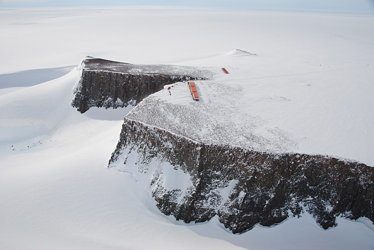
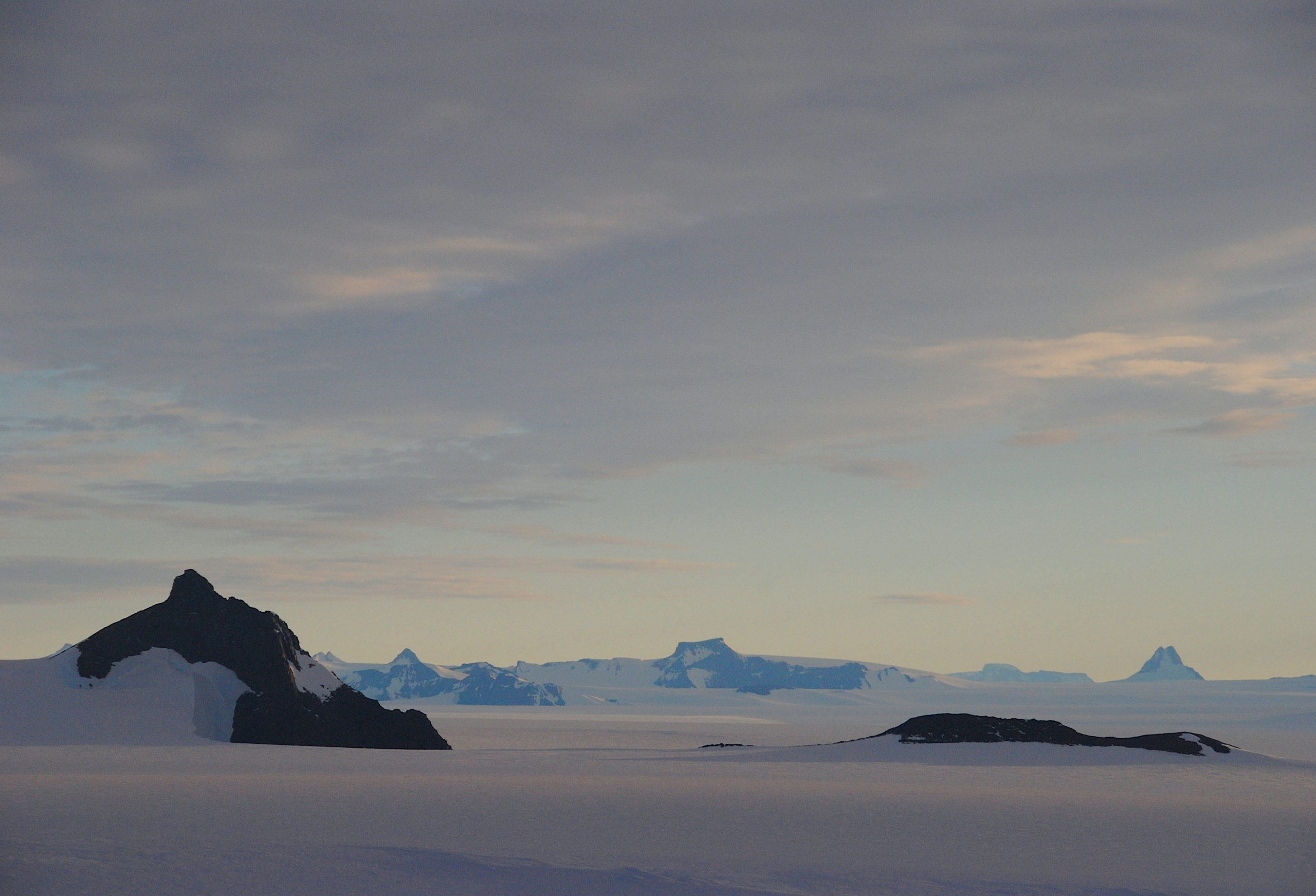
The Riiser-Larsen Sea lies just off the East Antarctic continent’s Queen Maud Land region, a monumental landscape of snow, ice and rock mostly inhabited by minute life such as moss piglets, and research stations such as those maintained by South Africa and Russia for about six decades.
As the snow petrel flies over the ice shelf edge, the nearby sedimentary basins and abyssal plains of the Southern Ocean once abutted South Africa’s Bushveld Igneous Complex when Antarctica slotted into Gondwanaland about 180 million years ago.
South Africa’s East Antarctic research station, Sanae IV, on the pancake-flat Vesleskarvet nunatak in Queen Maud Land, at 71°S 2°W. (Photo: Tiara Walters)
Today, the South African complex is the biggest layered igneous intrusion in the Earth’s crust. Its bounty of chrome, platinum, palladium and other possible mineral resources offer tantalising clues to why East Antarctica’s modern-day waters, as well as the continent itself, appear to be of such interest to possible prospectors.
In 2019, PMGE aboard the Karpinsky also zeroed in on the Pacific wedge that pushes up against the West Antarctic ice sheet, the continent’s fastest-melting section under a changing climate caused by burning, among others, fossil fuels.
Here, the polar vessel trained her crosshairs on the Amundsen Sea as well as the Ross Sea, since 2016 the world’s largest marine protected area at 1,5 million km2 – which lapses mid-century at the end of the 2051/52 fishing season if the treaty’s fisheries commission ultimately fails to renew consensus on the future of this protected zone.
“In 2019,” the communiqué says, “PMGE has started the comprehensive geophysical research of underexplored areas of the Antarctica Pacific sector between the Amundsen and Ross Seas.”
Released to dovetail with Russia’s disputed discovery of Antarctica in 1820, which is challenged by competing Western narratives, this announcement is laced in the language of prospecting and conquest.
The research, it adds, “confirms” Russia’s “leading position in the international Antarctic community”.
Unpacking Russia’s mineral expedition diaries – at sea and on land
The Rosgeo communiqué may create the impression that 2020 and 2019 marked the very first years since the 1990s that PMGE assessed the Southern Ocean’s oil and gas – as reported by some market media.
Reviewed by us in original Russian form, our dossier of evidence shows otherwise, exposing the granular details of how the Karpinsky’s oil and gas assessments have unfolded after the 1998 ban formally entered into force in Madrid – to giddy international fanfare from environmental groups and politicians alike.
In addition to the polar vessel’s latest sorties, her post-ban mineral resource activities appear to amount to at least two decades of hydrocarbon investigations along much of the Antarctic Circle.
Between 2021 and 2006, her expedition diaries, compiled under state contracts, also appear to be replete with exhaustive, commercially weighted descriptions of Antarctica’s suggested mineral wealth – these diaries size up possible resource stock as the “geological and geophysical study and assessment of the mineral and raw material potential of the subsoil of Antarctica and its marginal seas”. Contractual iterations of this wording appear in the expedition diaries at least 20 times since 2006; while PMGE’s illuminating 55th anniversary report places the “identification of large sedimentary basins” in the “Antarctic, promising for oil and gas” at the very top of the subsidiary’s milestone pile.
To provide a broad picture of this annual work, here we highlight translated, summarised examples from the summer-season diaries, undertaken not only at sea, but also via aerial geophysical surveys over continental Antarctica. These examples offer by no means an exhaustive picture of the assessments, which can be reviewed in more detail on PMGE’s website.
- 2020-18 – “Continental geological and geophysical studies of Queen Mary Land and Bunger Oasis… Based on the results of offshore work… prospects for oil and gas potential were determined… Field work was successfully completed to study and assess the mineral potential of the subsurface in the northwestern part of the Weddell Sea, the western part of the Bunger oasis, and the western part of Wilhelm II Land.”
- 2016 – “Field work on the study and assessment of the mineral resource potential of the bowels of the eastern part of the Weddell Sea and the mountainous regions of Princess Elizabeth Land… was successfully completed.”
- 2013-12 – “Point copper, molybdenum and magnetite ore occurrences of mineralogical interest are noted within the Clemens Massif.”
- 2012 – “The total area of the eastern part of the sedimentary basin of the Commonwealth Sea (together with Prydz Bay) and the Princess Elizabeth basin studied… is about 320,000km2; total forecast resources – about 4.5 billion tons of standard fuel.”
- 2011 – “In the D’Urville Sea basin (230,000km2), the volume of sedimentary material is calculated at not less than 1 million m3, which makes it possible to assess the hydrocarbon potential.”
- 2009-6 – “Assessment of the mineral resource potential of the subsoil of Antarctica and its marginal seas (the eastern part of the Commonwealth Sea, mountainous regions of Mac Robertson Land).” Diary reports for this year include the Davis Sea and Princess Elizabeth Land.
The Ahlmannryggen range in the Norwegian-claimed territory of Queen Maud Land, East Antarctica. (Photo: Tiara Walters)
In order to greenlight this work, an environmental impact assessment submitted to the treaty by the Russian Antarctic Expedition – the state agency that executes Russia’s Far South activities – emphasises the Port of Cape Town as a strategic but legal transit node stretching as far back as 2001.
The same impact assessment also outlines as a top objective the “preliminary assessment of the oil-gas bearing perspectives of the Cosmonauts Sea” in Antarctica, as well as planned work in other East Antarctic seas, which have since delivered a vast body of hydrocarbon data from thick sedimentary basins, more than 7km thick in parts, in vulnerable marine habitats.
These undulate across several-thousand nautical miles – from the Mawson and D’Urville seas facing Australia, all the way to the Riiser-Larsen Sea facing South Africa.
Authorities from the South African National Antarctic Programme and national Department of Environmental Affairs did not respond to requests for comment on whether enabling port access for potential Antarctic prospecting activities was consistent with the country’s global climate commitments and new Antarctic strategy, which prioritises a “climate action” response.
The high-impact science behind the expeditions
We tracked some of the scientific results of the Karpinsky’s expeditions to, among others, a 2014 geology paper on tectonic evolution, published in Springer Nature’s Geotectonics, a high-impact, peer-reviewed journal. Although the paper does not seem to divulge a modicum of interest in oil, gas or minerals, other papers by PMGE et al., published through the same academic group, seem to do exactly that. Among hydrocarbon-related findings released since the 1998 ban entered into force, these papers include a 2020 Russian research effort, published in Geochemistry International. This attempts to tease apart, not so subtly perhaps, the “hydrocarbon generation in the Eastern and Western Mawson Sea (Antarctica)”.
Data for a 2008 study, published in Marine Geophysical Researches, were drawn from 1996 and 1998-9 investigations under the Russian Antarctic Expedition. From 2002-4, the Karpinsky’s cruises were done “under a cooperative agreement between PMGE and the Norwegian Petroleum Directorate” – a specialist directorate and administrative body reporting to Norway’s Ministry of Petroleum and Energy.
In an emailed response, the directorate told Daily Maverick that the 2008 study was of a scientific nature, and not a “resource-mapping project” – the data were publicly available through the Scientific Committee on Antarctic Research (SCAR) and used to help determine the Antarctic continental shelf in line with UN maritime law. As “Norway’s professional agency for mapping the borders of the continental shelf”, the directorate contributed project financing. The country’s involvement in the mapping was “accepted by other treaty nations”, but it asked the UN to put aside its submission “for the time being” – as the treaty freezes territorial claims.
Replying to our request for clarification of Russia’s geological activities in Antarctica, a senior Russian state scientist associated with each of these papers responded that Russia “already commented our position on geoscience research in Antarctica at one of the ATCMs [Antarctic Treaty consultative meetings]”.
That scientist is German Leitchenkov, deputy-director general and Antarctic geoscience coordinator for VNIIOkeangeologia, the state marine-geology institute and scientific collaborator of PMGE.
To explain Russia’s position, Leitchenkov shared with us an early draft version of what appears to be “Information Paper IP-014”, a document ultimately tabled by Russian state officials at a 2002 Warsaw treaty meeting in response to accusations over “mineral exploration”. We publish the full draft here. It is not only more descriptive in scope than Information Paper IP-014, it also does not rule out “activities related to actual utilisation of the Antarctic mineral wealth”, although these may “only occur in the indefinitely remote future”.
A draft of “Information Paper IP-014”, tabled by Russia at a 2002 Warsaw treaty meeting. The final version, less detailed than the draft published here, can be viewed on the Antarctic Treaty database.
In an email exchange with Daily Maverick, an exasperated Leitchenkov – whose VNIIOkeangeologia research profile notes multiple assessments of the Antarctic’s “subsoil mineral potential” – said that we had “not learnt the problem and situation in detail”.
He wrote that he had contributed “great efforts” towards open data, “all” viewable on the Antarctic magnetic anomaly project, SCAR database and Antarctic Seismic Data Library System – with the latest data currently being prepared.
Leitchenkov, a polar geology professor at St Petersburg State University, cited as achievements “a lot of publications based on our marine geophysical data”; cooperating “with colleagues from many countries” on, for instance, ice-sheet dynamics; and “our great contribution to Antarctic geoscience”.
“I think that the statement of officials from ‘Rosgeologia’ is a fake due to their very low competence in fundamental Antarctic research,” he concluded.
Read our request for comment to Leitchenkov here:
Daily Maverick’s comment request to German Leitchenkov, VNIIOkeangeologia Antarctic geoscience coordinator and polar geology professor at St Petersburg State University.
Apart from the communiqué, assessments of 70 billion tons appear in other official and state documents.
PMGE’s 50-year anniversary report, published in 2012, reveals that “the most important area of research carried out by PMGE in Antarctica is a comprehensive geological and geophysical study of its marginal seas”. The “practical” dimension of this research is “aimed at assessing the predicted hydrocarbon potential of the sedimentary basins of the marginal seas, which in general for the Antarctic is about 70 billion tons of fuel equivalent”.
Tucked into a single line of an October 2010 document that sets out Russia’s formal Antarctic strategy to 2020 and beyond, the 500 billion barrel estimate pops up again as “hydrocarbons” in “vast sedimentary basins” that can reach “70 billion tons” of fuel. It is published on Rossiyskaya Gazeta, the official government gazette.
Rosgeo responds: ‘A nature reserve intended for peace and science’
Rosgeo’s February 2020 communiqué may have claimed that it was a central objective of the most recent expeditions to probe the Antarctic shelf’s “oil and gas-bearing prospects”. Even so, in response to our request for comment, the exploration company told us that it was “in no way engaged in the exploration and exploitation of Antarctic mineral resources” – or any activity “going beyond the standard boundaries of non-commercial geology”.
The exploration company’s reply to Daily Maverick, produced on behalf of itself and PMGE, also notes the following:
- Other than carrying out Russian interests “to preserve Antarctica as a nature reserve intended for peace and science”, the purpose of Rosgeo and its subsidiary’s research is “exclusively scientific in nature” – that is, using geology and geophysics to understand the Antarctic’s origins, structure and marine sedimentary cover better;
- This is borne out by the Russian Federation’s Antarctic action plan up to 2030, which is interested only in the scientific assessment and forecast of the region’s mineral resources, says the exploration company.
- Judged only in the “most general” way, possible hydrocarbon distribution in Antarctic seas is not only a natural byproduct of such geological inquiry, but a necessity of scientific professionalism.
To afford Rosgeo and PMGE the right of full reply, we publish the complete statement here.
Rosgeo offered a substantive response, insisting that the exploration company and its subsidiary were interested only in non-commercial scientific inquiry and preserving the Antarctic as a “nature reserve for peace and science”.
Russia has ratified all treaty agreements, including the Madrid Protocol. Executive authorities have also introduced a raft of domestic laws on regulating activities of Russian citizens and legal entities in Antarctica.
Valery Lukin, former veteran head of the Russian Antarctic Programme, in a 2017 Madrid Protocol analysis calls the agreement “the most important event in the overall development of the Antarctic Treaty System”. Lukin also argues that Russia under the protocol – regardless of facing economic pressures – invests in costly natural-resources assessments in Antarctica for the benefit of all humankind.
The treaty’s Committee for Environmental Protection did not respond to our request for clarification on the nature of Russia’s resource assessments. SCAR, an independent but influential treaty advisory body, declined to comment. So did Antarctic Treaty Executive Secretary Albert Lluberas, who noted that the secretariat did “not provide comments on situations or actions as it is not in our mandate”.
According to the treaty secretariat’s website, to which Lluberas referred us, the secretariat’s mandate includes “ensuring that all activities in Antarctica are consistent with the purposes and principles of the Antarctic Treaty and its [Madrid] Protocol on Environmental Protection”.
The ‘freedom of scientific investigation’ jamboree
Amid tensions over the true difference between mineral research and prospecting in the endangered Antarctic, polar law expert Donald Rothwell told us that the Madrid Protocol’s internationally lauded mining ban does not “prohibit research activity into oil and gas”. An Australian National University professor, Rothwell advised that the “protocol has to be read against the Antarctic Treaty’s ‘freedom of scientific investigation’ principle”.
And it is this principle of unfettered science that dominates the lion’s share of realpolitik in the Antarctic – in theory, an extreme St Nowhere in which the treaty constitution suspends all territorial possession, halts aggressive military activity, forbids nuclear tests and outlaws radioactive waste.
Here, the 1959 US-led international push reserved an entire continent and its surrounding oceans for “peace” and, of course, “science”. Today the Antarctic is governed by just 29 countries that can afford the expense of doing the substantial scientific research necessary to secure a vote at the decision-making table. A further 25 countries have observer status.
To say that the ban “expires”, as commentators often erroneously do, is to advertise that one has failed to grasp its mechanics – but 2048 signals the year when it can be reviewed, for the first time, without unanimous agreement. To transform the ban into extraction, three-quarters of the treaty’s voting parties ultimately have to say “yes”. Such changes must include all 26 countries seated at the treaty voting table during the Madrid Protocol’s 1991 adoption. They would also have to produce an agreed, binding regulatory regime. That means, from mid-century, the ban can potentially be fundamentally altered – not just for hydrocarbons, but also for mineral extraction.
‘Clear examples of prospecting’
This is cold comfort for some, such as the University of Canterbury’s Alan Hemmings, an Antarctic governance professor and co-author of the Handbook on the Politics of Antarctica. Hemmings was the commander of the British Antarctic Survey station during the 1982 Falklands war between Argentina and the UK.
From Hemmings’ personal files, he shared with us his own document entitled “Russia and Antarctic Prospecting”, dated 13 March 2007. In it, he chronicles “clear” examples of Russia “asserting minerals and prospecting interests in the Antarctic since 2001”, including early 2001 media reports in which Russian officials are quoted referring to prospecting activities.
Also supplied by Hemmings, a “particularly significant” article from the Russian political daily Kommersant, dated 22 January 2003, quotes a senior government official on a 2003 Antarctic expedition, saying the Karpinsky was to “prospect the sea shelf, which, in our estimates, accommodates from 12 to 17 billion tonnes of hydrocarbons”.
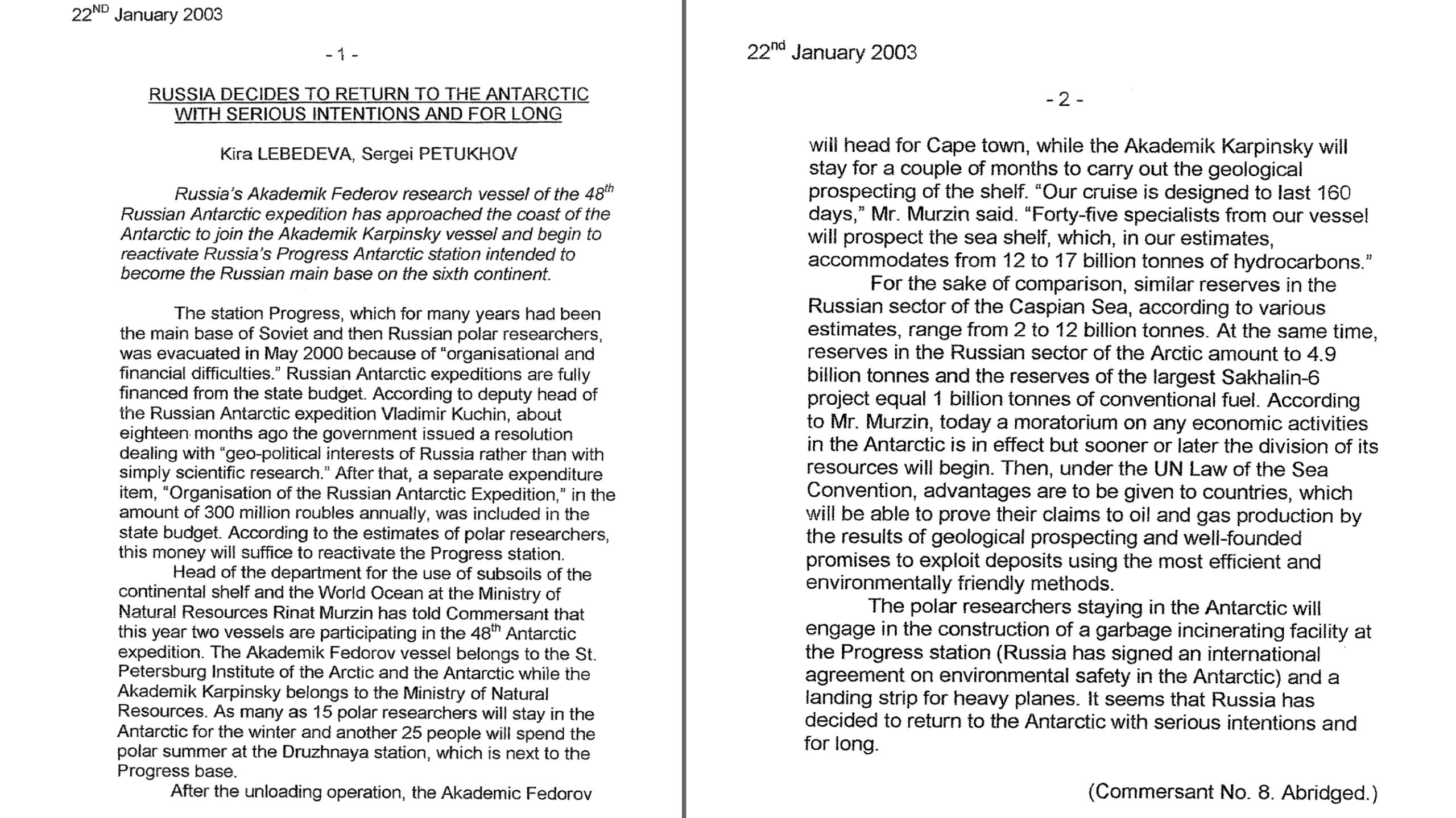
A January 2003 Kommersant article, quoting a Russian official on the plans of 45 “specialists” to “prospect the sea shelf” aboard the Karpinsky.
At the treaty’s July 2001 meeting of member countries – held in St Petersburg no less – references to “resource potential” emerged in a Russian working paper. Hemmings remarks that the Russians had not only pleaded translation issues, but that they were compliant with the ban. In the margins of the meeting, however, they apparently told the Antarctic governance specialist that the Madrid Protocol’s breaking point between science and prospecting was not clear.
“This is a weak defence,” Hemmings jotted down in his notes. “There are a number of globally used criteria for setting breaking points.”
‘Great embarrassment’
“Remarkably,” Hemmings’ notes continue on another example of possible prospecting, “while the exchanges referred to above were proceeding, a couple of us spotted a Russian science poster in the coffee room adjacent to the meeting room which also emphasised minerals interests.”
The poster featured the headline “1991-2001”, accompanied by a picture on the Russian Antarctic Expedition, Hemmings reports in a brief article for a 2001 edition of ECO, an NGO newsletter.
Immediately below the picture and Cyrillic text was a sheet of paper featuring none other than the official logo of the 2001 treaty meeting, Hemmings writes. Peeling back that logo, the Antarctic governance specialist reports finding beneath it a covert caption, written in English, on the research station Progress:
“Progress is established in 1988 to carry out geological-geophysical studies,” it said, “in one of the most prospective places in East Antarctica in terms of mineral and petroleum resources. An air transport junction is planned to be here.”
That apparently the caption had been concealed from immediate view, he concludes, means “somebody was obviously aware of the implications”.
In response to this incident, he proceeded to “ask a question from the desk of the Antarctic and Southern Ocean Coalition”, an NGO representing international environmental interests in the region.
“There was great embarrassment,” Hemmings told us during a virtual interview, “that this should even be raised.”
Ice to see you, Karpinsky
On 4 February 2021, almost a year after Rosgeo’s 2020 communiqué, the Karpinsky nosed into the Southern Ocean via Cape Town port yet again, this time under state contract “No. 1.1.4/2020/PMGRE of 17.11.2020”.
The polar vessel’s self-declared mission? Gathering data on paleoclimates; Gondwanaland’s prehistoric split into Antarctica, Australia, India and the Indian Ocean; and the structure of marine sedimentary basins.
She returned to Cape Town on April Fool’s Day, where she spent several weeks tethered to the most inaccessible point of the farthest pier at Table Bay harbour. Apart from her latest oil and gas assessment, she had been moored at various piers in the bay for more than a year, finally setting sail for her native port in St Petersburg on 26 June 2021, according to Marinetraffic.com data.

The Karpinsky in Table Bay harbour, June 2021, shortly before departure. (Image: Marinetraffic.com)
If the past two decades are a measure of things, the Akademik Alexander Karpinsky is expected to return to Antarctica via Cape Town for PMGE’s planned mineral investigations during the 2021/2022 summer season and beyond, notes an announcement by the Arctic and Antarctic Institute (AARI). Marking its 100th anniversary last year, AARI manages diverse scientific disciplines under the Russian Antarctic Expedition, including climate research that has contributed to leading IPCC reports.
“I am glad that we have resumed the scientific programme of the seasonal expedition,” said AARI director Alexander Makarov, who did not respond to a request for comment on the nature of certain Russian scientific disciplines in Antarctica.
“The past year was, due to the pandemic, in many respects, difficult. We have a lot of restrictions, a lot of ‘ifs’,” Makarov continued. “But the main thing is that the season will be.” DM/OBP


Now that this has been discovered it might be the ideal time for an international treaty on leaving it where it is.
This takes my breath away.
Ditto.
Who would own the resources if they were commercially viable? Pity oil is at $85 rather than $25!
It’s always the same culprits regarding unethical environmental behavior. It’s almost as though some nations are “narcissistic” and unable to view things other than from their own narrow, personal point of view