




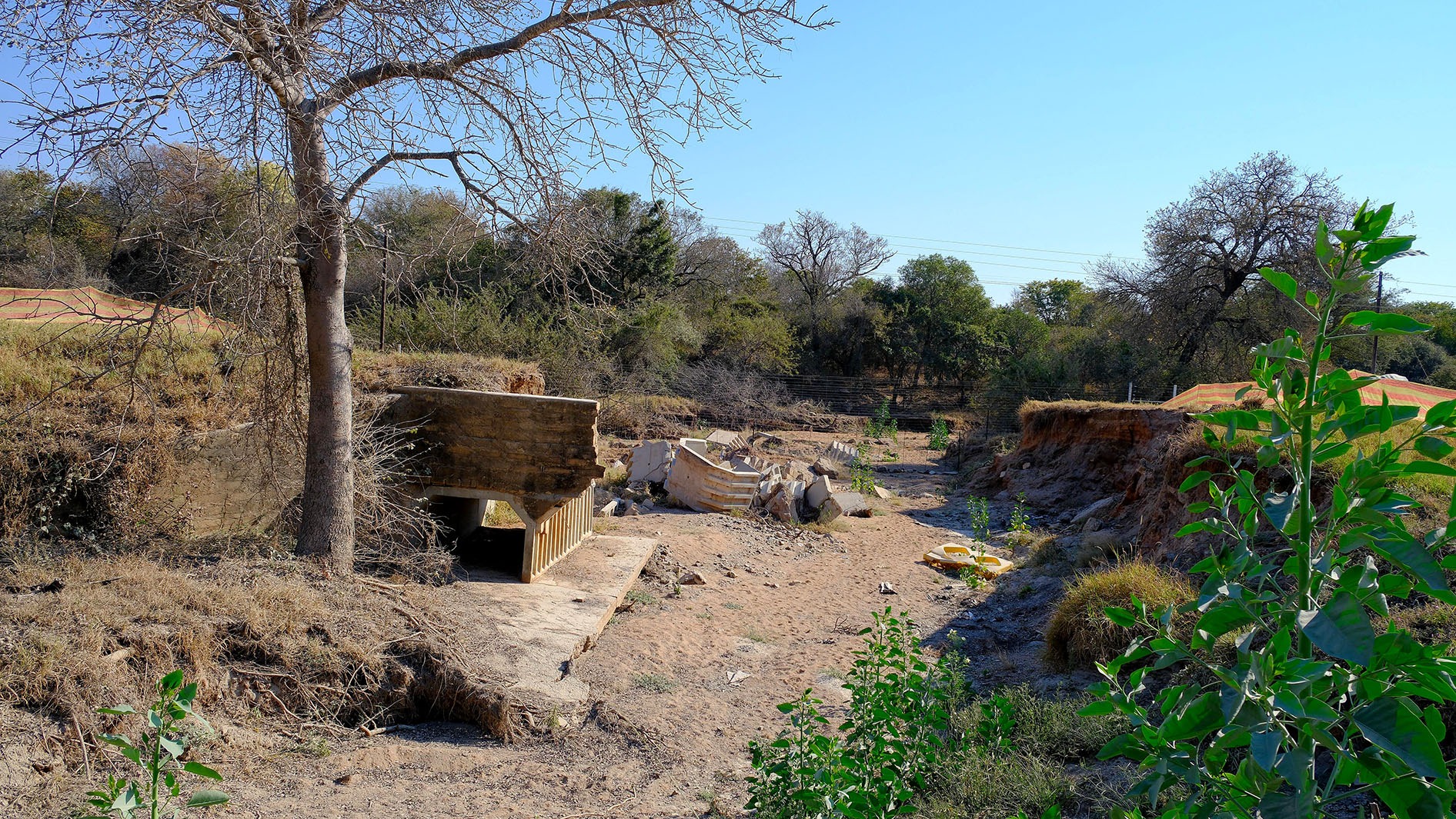
 Flooding on the R40 between Hoedspruit and Phalaborwa sent this culvert downriver. (Photo: Don Pinnock)
The first sign was a number Terry Baker had never seen before. Baker, who helps run Hoedspruit Farm Watch, subscribes to the daily weather alerts. He watched the warning climb from level one to level two, then level three. Suddenly it was at level 10.
“I’ve never, ever seen a level 10 alert before,” he recalls. “That’s when we realised: okay, something big is going to happen.”
Then the rain arrived. It began on a Thursday, strengthened the next day and grew heavier again on the third. Over four days, Baker says, 956mm fell where he was staying. This was not the familiar tropical downpour that pounds the Lowveld for 20 or 30 minutes before easing. It went on and on.
“That rain just never stopped,” he says. “It was relentless. For me, that rain was scary – actually very scary.”
/file/attachments/orphans/WeatherServicewarning_509474.jpg "Red level weather warning as the storms hit. (Source: SAWS)")
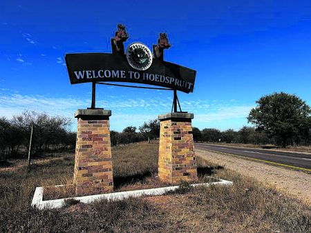
Hoedspruit sits along the western edge of Kruger National Park, in a landscape knitted together by rivers, wildlife estates, farms, lodges and a small number of critical roads. As the park’s own restoration teams began assessing damaged roads, bridges and tourism infrastructure, the town beyond its boundary was confronting the same water on a more intimate scale: homes, livelihoods, power lines and supply routes were all exposed.
Farm Watch had checked its satellite communications and radios and was as ready as a volunteer organisation could be. But a disaster plan cannot anticipate every crossing, stranded guest or fallen line. Many volunteers were also protecting their own families and properties.
Rivers rising
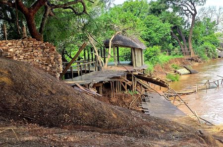
At the same time, the Blyde River was climbing towards the underside of a bridge that serves as one of Hoedspruit’s lifelines. Soon it was over the road and, Baker says, roughly two metres above it, pouring across the balustrade.
The bridge carries the route through the tunnel into town, a key corridor for food, fuel and other supplies. Farm Watch helped barricade the approach. Elsewhere, roads towards Phalaborwa were severed or damaged and rivers cut off estates and reserves. People might be able to reach a gate on foot, but their vehicles could not cross. Plans were made to leave vehicles on the accessible side so residents could collect supplies.
/file/attachments/orphans/Rainfall_694140.jpg "A weather Service rain map for the flood period. (Source: SAWS)")
Not everyone turned back in time. On one flooded detour, two vehicles and a caravan were swept about 1.5km downstream. The occupants were recovered, but the vehicles had to be abandoned in deep mud until conditions improved.
At the Olifants River, the water rose to within about a metre of the main bridge deck. Two lower bridges nearby were already under .
“It was absolutely phenomenal how quickly it was rising,” Baker says.
Response
The response was improvised, but not chaotic. Farm Watch worked alongside the authorities, used private vehicles and winches, and commissioned helicopters to evacuate people stranded in the bush and deliver food and water to lodges whose guests could not leave. The cloud ceiling sometimes made flying impossible.
Mariepskop, an old radar station that now carries vital telecommunications equipment, became a particular concern after lightning and water affected equipment and the mountain road became impassable. Crews worked to reopen enough of it for a 4x4, quad bike or motorbike to get through.
There were moments of distinctly Lowveld complication. While volunteers kept motorists away from a flooded bridge, hippos wandered onto it. “We had to contend with the hippos on the bridge,” Baker says, laughing at the memory now. It is an almost comic detail, but it captures the reality of emergency work here: water, wildlife and infrastructure cannot be separated.
Once the water dropped, the rescue operation became a restoration drive. Within about two days, teams were clearing branches and debris from the Zandspruit Bridge with bulldozers. Floodwater had stripped tar from the point where the bridge met the road, so the community supplied material and paid for repairs under Sanral supervision.
/file/attachments/orphans/Krugerfloods_634286.jpg "A common sign for weary motorists. (Photo: Don Pinnock)")
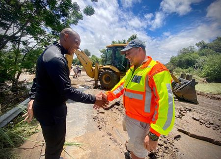
Farmers brought bulldozers, Farm Watch helped with diesel, residents contributed money. Secondary roads leading to reserves were patched so that people, workers and supplies could move again.
Eskom’s network had also taken a beating. Trees had pulled down lines, other infrastructure was submerged or broken and repair vehicles repeatedly became bogged down. Volunteers towed them out so technicians could continue. Within days, Baker says, power was returning and the Zandspruit crossing was functioning again.
Speed was important, but so was the spirit behind it.
“I wouldn’t live in any other community,” Baker says. “We know that we’re isolated, we pull together.” The community later helped Farm Watch recover some of the cost of aircraft, fuel, vehicle use and damage. Most importantly, he says, no lives were lost to the floods in the Hoedspruit area – an outcome he regards with both pride and relief.
The long road
Recovery, however, is not the same as completion. Baker identifies several strategic routes still demanding permanent attention. A damaged road towards Kruger requires a rough detour that adds 20 to 30 minutes to a trip. Two bridges on the Phalaborwa road also need repair.
Mine trucks have been diverted onto a secondary road never designed for hundreds of heavy vehicles a day, accelerating its deterioration. Contracts, he understands, have been allocated, with work expected to begin around November. Until then, emergency patches and detours carry an outsized burden.
The floods also delivered lessons. Hoedspruit needs reliable access to telecommunications sites even when helicopters cannot fly. It needs a plan for clean water when boreholes turn muddy – reassuring evidence that aquifers are recharging, but a practical problem in an emergency.
/file/attachments/orphans/Krugerfloods-2_120581.jpg "The R40 between Hoedspruit and Palaborwa was cut and at time of writing has not been repaired. (Photo: Don Pinnock)")
/file/attachments/orphans/Krugerfloods-35_218787.jpg "The experience for many visitors even seven months after the floods. (Photo: Don Pinnock)")
Backup satellite communication, access to aircraft, medics and off-road vehicles all proved their worth. Yet Baker resists the idea of a perfect template: every flood strikes different infrastructure, and water reaching Hoedspruit may have fallen far upstream in the Olifants catchment.
The scale was exceptional. Baker notes that floods marked in Kruger from 2000 remain part of the region’s memory and says the old flood line was exceeded this time. The lesson is less that Hoedspruit can prevent the next deluge than that it must preserve the relationships and access that made a fast response possible.
These days, when a weather alert arrives, he looks closely at the level. The fear has not vanished, but neither has the confidence earned in January. The lasting image is not only a river swallowing a bridge or rain hammering a roof for days.
It is farmers arriving with heavy machinery, volunteers towing the power utility’s vehicles from the mud, residents paying for tar and diesel and a small town on Kruger’s border deciding, almost immediately, to put itself back together. DM


Comments
Scroll down to load comments...