




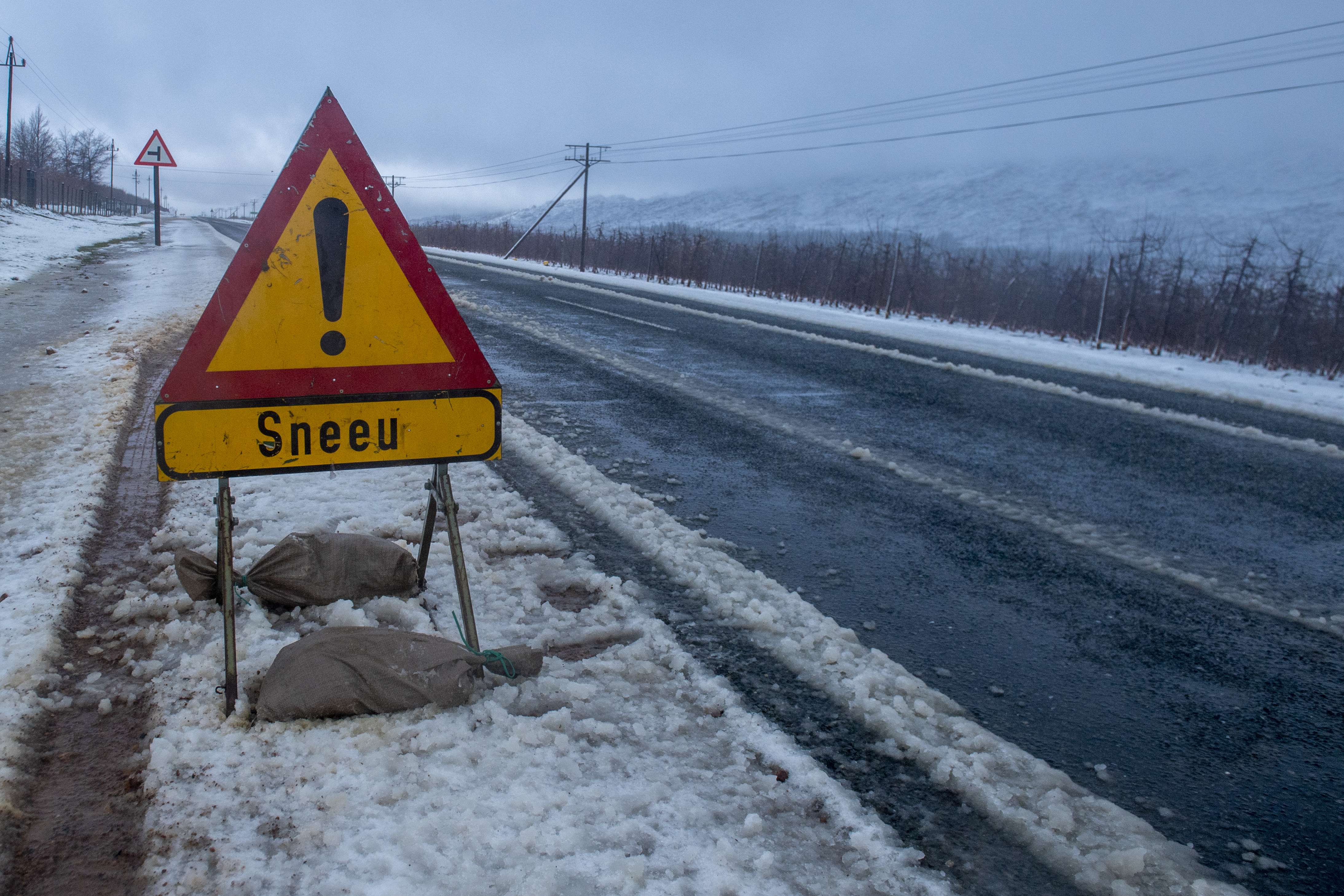
 Snow forced the closure of several roads in KZN and the Eastern Cape on Monday. (Photo: Jaco Marais / Gallo Images / Netwerk24)
Over the next few days, South Africa is in for freezing temperatures and even snow as a severe cold front rolls through the country.
South Africans can expect unseasonal rainfall on Tuesday and Wednesday, with the central, eastern and southern parts of the country experiencing scattered showers. The southeast and eastern regions are likely to experience widespread showers, while in the mountainous areas of the Eastern Cape, KwaZulu-Natal, Mpumalanga and Free State, snowfall is expected.
Safety precautions
The Government Communication and Information System (GCIS) urged the public to avoid unnecessary travel to areas affected by heavy snowfall, ice, strong winds, flooding or other hazardous weather conditions.
It requested motorists not to attempt to drive on roads that have been closed by traffic or emergency authorities and warned that the public should check the latest weather and road conditions from verified sources before undertaking long-distance journeys. Travel should be postponed until conditions have improved and affected routes have been assessed and declared safe, if possible.
Travellers should avoid sharing unverified information about road closures and weather conditions, and precautions should be taken to protect children, older people and other vulnerable people from extreme cold.
Heavy snowfalls
On Monday, South Africans posted images on social media of heavy snowfalls in the Eastern Cape and KwaZulu-Natal.
The snowfalls forced the closure of several Eastern Cape mountain passes on Monday, including Penhoek, Boesmanhoek, Barkly Pass, the R405, R415 and the N9. Transport Department spokesperson Unathi Binqose confirmed graders were clearing the roads. While no accidents were reported, rescue teams freed travellers trapped in their vehicles on Barkly Pass in the early morning hours before the closures.
/file/attachments/orphans/771856041_10245110866208563_8422667982181646546_n_716852.jpg "Snowfall in Dordrecht, Eastern Cape. (Photo: Facebook / Luzette Achille Francesco Wheeler)")
Several routes reopen in KwaZulu-Natal
KwaZulu-Natal also faced heavy snowfall and road closures on 10 August, although several key routes have since reopened, including the R617 from Swartberg to Evatt, the R617 from Underberg to Kokstad, the R56 from Kokstad to New Amalfi (Matatiele), and the N2 from Kokstad to Brook’s Nek and from Kokstad to Beestekraal, according to Transport and Human Settlements MEC Siboniso Duma.
Department spokesperson Ndabezinhle Sibiya noted that the closures were part of the province’s Snowfall Response Plan, which includes clearing snow off roads before it exceeds 30cm in depth.
South Africa’s cold front
South African Weather Services forecaster André Fourie said the weather system was not out of the ordinary.
The severe weather is linked to the combination of an upper-air and a surface weather system, he explained. The upper-air cut-off low system pulls cold air and rainfall down to the surface, while a surface cold front sweeps cold air across South Africa.
/file/attachments/orphans/767002334_10164313996853286_3078099350380086494_n_443589.jpg "Snow between Lady Grey and Barkley East. Cold and windy. (Photo: Facebook / Marietjie Hattingh)")
Fourie said the weather is expected to start clearing up from Wednesday, when the eastern parts of South Africa can expect isolated showers, with a 60% chance of rain in KwaZulu-Natal.
On Thursday, KwaZulu-Natal’s coast and adjacent interior face a 60% chance of rain, while the rest of the province, along with the Lowveld and central parts of Mpumalanga and Limpopo, have a 30% chance. Meanwhile, Gauteng is set for single-digit daytime temperatures over the next two days, with rain and potential thundershowers expected. DM
Comments
Scroll down to load comments...