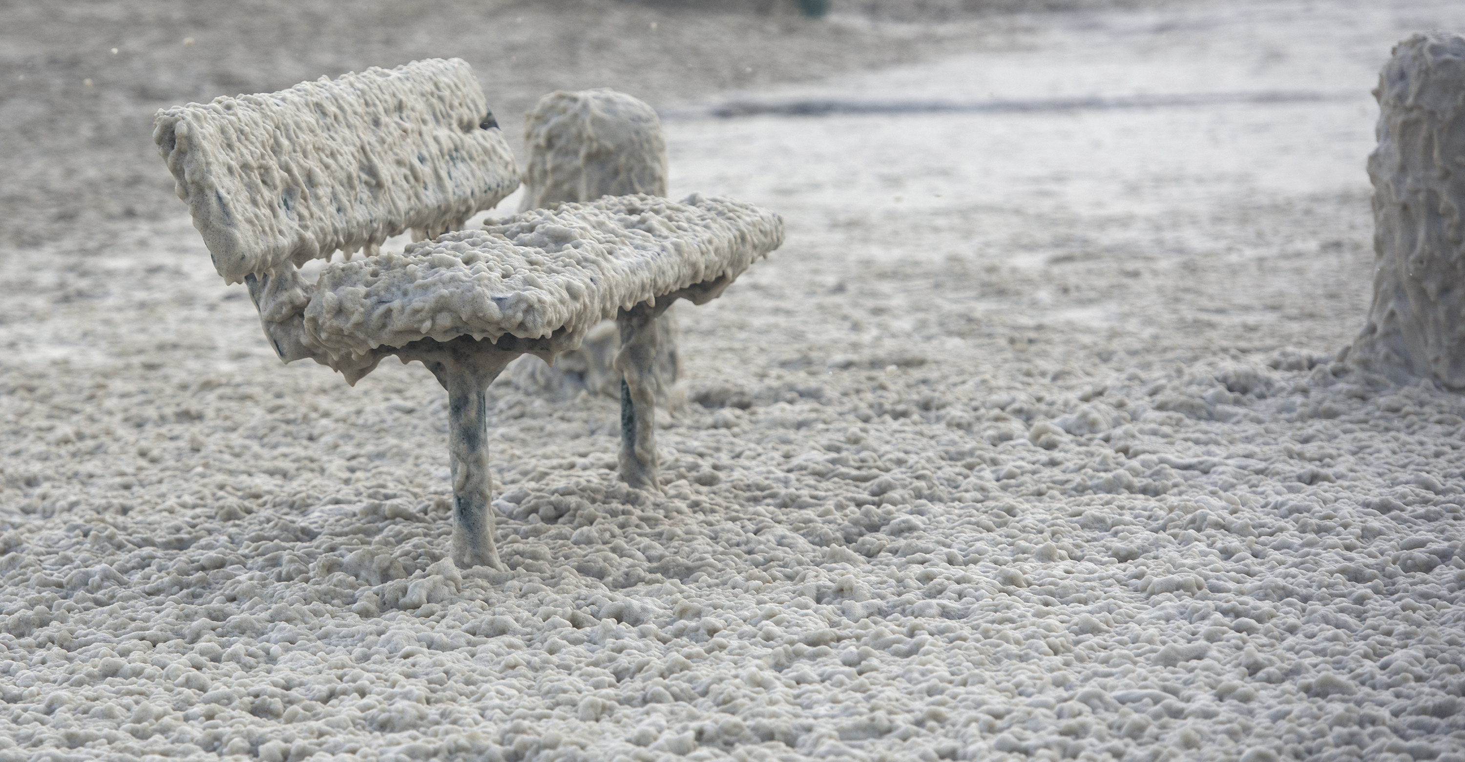
 A bench covered in sea foam at Three Anchor Bay in Cape Town on 8 July 2024. (Photo: Gallo Images/Brenton Geach)
 In an era of a globally changing climate, African countries have often had to make decisions about ports, housing, flood protection and coastal development without a clear historical record of how sea levels have shifted at specific locations.
A new climate adaptation tool launched on 15 June aims to change that.
Developed through a collaboration by researchers at the University of Ghana, Université Félix Houphouët-Boigny in Côte d’Ivoire, the University of Lagos in Nigeria and Harvard University in the US, the interactive tool reconstructs sea-level change at 950 locations around Africa’s coastline from 1900 to the present time.
“Going back to 1900 is possible both because you have tide gauges and because you have these physical models of how sea level changes,” said Gabe Cederberg from Harvard’s Department of Earth and Planetary Sciences. Cederberg designed the tool, based on research from Tulane University, also in the US.
Long-term tide-gauge records may be more complete for parts of Europe and North America, but observations across much of Africa’s coastline have remained intermittent.
By merging available measurements with physical models of how oceans respond to ice melt and warming, this project addresses one of Africa’s most persistent climate data gaps in unprecedented detail.
“Tide gauge records are sparse and discontinuous across most African coasts,” said Dr Rebecca Berkoh-Oforiwaa, a postdoctoral Fellow in atmospheric physics at the University of Ghana. “These gaps present a critical challenge.”
The tool, then, gives coastal states local evidence of which adaptation decisions can no longer be delayed, while projecting possible futures to 2100 under three emissions scenarios ranging from low to high.
950 coastal locations, 950 stories
Understanding which factors dominate in a certain location could help explain why the rising ocean is accelerating faster in some places than others.
So, among this tool’s most compelling insights is that sea-level rise involves at least several hundred site-specific stories rather than a one-dimensional narrative.
In multiple nodes scattered all along the South African coast, for instance, it shows rising seas that are driven by a mélange of forces from one sweep of coastline to the next.
/file/attachments/orphans/Harvard-climate-tool-Cape-Town_917021.jpg "Warming oceans and shifting currents (\"sterodynamic\" factors) could add about 22.4cm to sea levels around Cape Town by 2100. (Image: Harvard Climate Brief)")
Melting ice sheets, heating oceans that expand in volume, changing ocean circulation patterns and local land movement all contribute to the risks and consequences weathered by communities.
For a middle-of-the-road emissions scenario (or the “4.5” emissions pathway, as the graph puts it), Cape Town would get about 60cm of sea-level rise over the course of this century to 2100.
Ocean warming and circulation would change the city’s coastline by about 22.4cm. Glacier melt would yield around 14cm, while Antarctic ice loss would dump around 11.6cm on the city’s shores. Greenland would contribute a little less to the coastal city at roughly 10cm.
/file/attachments/orphans/DSC6537copy_275869.jpg "A group of friends from the Cape Flats enjoy cooling off at the Camps Bay tidal pool during excessive heat, with many people seeking relief along the coast, 11 March 2026. (Photo: David Harrison)")
/file/dailymaverick/wp-content/uploads/2024/05/Karpinsky-jogger.jpg "Framed by a rainbow, a jogger dashes along Cape Town's Sea Point promenade on 3 April 2023. (Photo: Nic Bothma)")
When the land sinks
The research also highlights a less visible threat.
In some African coastal cities, the greatest danger may not come from the ocean rising alone, but from the land itself sinking. Groundwater extraction and other forms of land subsidence can worsen relative sea-level rise and increase flood threats, even where global ocean changes are unfolding at more moderate rates.
So, where land subsidence fuels the consequences of rising seas, better groundwater management could dramatically reduce the risks.
The tool also forces a more difficult conversation, because not every coastline can be defended indefinitely.
Identifying where risks are likely to intensify under various emissions scenarios, the tool asks which areas can realistically be protected.
Yet, it also asks where managed retreat may eventually become unavoidable.
/file/attachments/orphans/Harvard-climate-tool-Africa_364102.jpg "Blue dots trace how rising seas have reshaped Africa's coast since 1900 and could transform it again by 2100. At the Lúrio River in Northern Mozambique, Antarctica is projected to contribute 12.2cm under a medium emissions scenario. (Image: Harvard Climate Brief)")
/file/attachments/orphans/Harvard-climate-tool-Durban_802494.jpg "Durban may have to adapt to an ocean that sits roughly 56.6cm higher by the end of the century. That is a lot, but slightly less than Cape Town's 59.9cm. (Image: Harvard Climate Brief)")
The ‘excruciating’ retreat question
“Managed retreat” may be the policy wonk’s polite way of framing the visceral ways in which the Anthropocene looks set to disrupt human lives.
According to Harvard University’s Salata Institute for Climate and Sustainability, such retreat is the “excruciating choices about where to build protections and, in some cases, what land should be abandoned”.
“Antarctica is giving us clear signals of what might be coming to change our lives. And I mean everyone’s lives. You can drive around and look at all of these buildings on the foreshore in Gordon’s Bay and Strand and all these other places,” Professor Steven Chown of Australia’s Monash University previously told Daily Maverick while discussing changes for greater Cape Town.
A former president of the Scientific Committee on Antarctic Research, Chown was not involved in the study.
“This infrastructure will be gone soon. I mean, come on, 40cm are well over the beach and past the first set of apartment blocks. Where will those people go? What will happen to the investments? When will the insurance decline to zero?
“What are we going to do about all that?” he asked. “And that speaks nothing of the situation on the Cape Flats.”
/file/dailymaverick/wp-content/uploads/2025/03/PrincessVlei.jpg "Princessvlei on the Cape Flats shows ‘threshold type behaviour’, or tipping points, due to climate change. (Photo: Dr Jemma Finch, palaeoecologist)")
“The tool shows that Antarctica is an important contributor to future sea-level rise around South Africa,” notes the University of Ghana’s Berkoh-Oforiwaa, but cautions that the country’s immediate southern neighbour is one part of the picture.
“The impacts are likely to include more frequent coastal flooding, increased shoreline erosion, saltwater intrusion into estuaries and groundwater systems, and growing risks to ports, roads, tourism infrastructure and coastal communities ...
“Along South Africa’s east coast, this effect is particularly important because the warm Indian Ocean and the Agulhas Current contribute to higher ocean temperatures and increased sea-level rise.”
According to institute spokesperson David Trilling, the tool’s researchers will host a briefing in Lagos on June 27 to present a new book manuscript featuring case studies on the economic trade-offs of aspects such as coastal protection and the blue economy.
The event will also include an exhibition exploring how coastal landscapes and communities could be reimagined to adapt to climate change.
This tool cannot stop the sea from rising.
But it can, the researchers argue, identify vulnerabilities and weigh difficult trade-offs before the next century of change forces itself upon the entire continent.
“It’s a tool for the general public, but it’s also a tool for people who are interested in adaptation policies,” said Professor Jerry Mitrovica, the Harvard geophysicist whose lab developed the tool. “This is the first time these results have been visualised at local scale in such an accessible way.” DM