


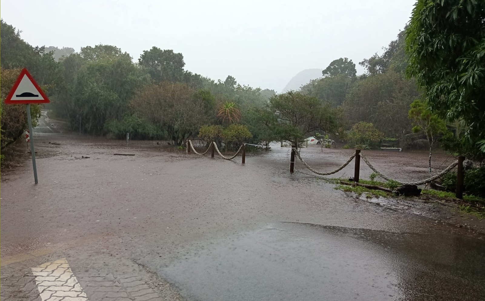
 A low-lying area in Nature’s Valley (Bitou Municipal Area) is inundated by rising water on 3 June. (Picture: Facebook / Garden Route District Municipality)
 The Garden Route is preparing for a second major storm in less than a month, with evacuations already under way on Wednesday and authorities warning that up to 200mm of rain could fall on ground still saturated from the devastating 6 May floods.
The South African Weather Service (Saws) issued an Orange Level 8 warning, the second-highest impact category on its scale, for the southern parts of the Western and Eastern Cape, with the Garden Route District of the Western Cape expected to be most severely affected.
/file/attachments/orphans/GardenRoutesevereweather2_905177.jpg "(Photo: South African Weather Service)")
The system is forecast to bring widespread heavy rainfall, strong winds, very cold conditions, and rough seas from Wednesday into Thursday, with fast-flowing streams and rivers posing a danger to life, and major transport routes at risk of flooding and poor visibility.
According to Saws, as cited by Western Cape Minister of Local Government Anton Bredell, the municipalities of Bitou, Knysna and George can expect accumulated rainfall of up to 200mm over the two days.
/file/attachments/orphans/GardenRoutesevereweather_990567.jpg "(Photo: South African Weather Service)")
The storm arrives in the worst possible conditions.
“Such significant rainfall on already saturated ground increases the risk of flooding in low-lying areas, informal settlements, roads and river catchments,” said Bredell on Tuesday, 2 June. “Given the recent rainfall across the province and already saturated catchment areas, there is an elevated risk of rising river levels, dam spillages, infrastructure damage and disruptions to essential services.”
The Garden Route District Municipality’s head of disaster management, Gerhard Otto, warned on Tuesday, 2 June, that every dam in the district was currently at 100% capacity.
“Any water in addition to what is already in this area will just add to low-lying areas getting flooded,” he said. Otto added that road repairs carried out after the May storm were all temporary, meaning further road failures should be expected.
He also warned residents to be alert for fallen trees, noting that two people died after being struck by trees during the 6 May storm. Otto also confirmed that two areas in the district were still without electricity from the previous storm, with Eskom working to restore supply.
/file/attachments/orphans/Screenshot2026-06-03at1826copy_981303.jpg "The R340 into Wittedrift from the N2 was closed due to flooding on 3 June. (Photo: Facebook / Bitou Municipality)")
School closures
Following consultations with the Provincial Disaster Management Centre, the Western Cape Education Department announced that all public schools in the Eden and Central Karoo Education Districts would be closed on 3 and 4 June, citing learner and teacher safety. Schools are expected to reopen on Friday, 5 June.
Bredell said provincial and municipal disaster management structures had been activated and were closely monitoring developments, with emergency services on high alert, humanitarian support partners mobilised, and health and rescue services on standby.
Otto said farmers across the district had been advised to prepare supplies for up to 14 days, the period some rural communities were cut off following last month’s storm.
Evacuations and flooding
On Wednesday morning, the Garden Route District Municipality posted on social media that evacuations had already begun, with residents from Welgeluk and De Rust in the Oudtshoorn municipal area moved to safety as a precautionary measure due to rising river levels.
The district municipality said some mountainous areas had already received more than 60mm of rainfall between Tuesday night and early Wednesday morning. Stormwater systems were mostly coping at that stage, and no major life-threatening incidents had been reported, according to the district municipality, though monitoring of low-lying areas continued.
This storm follows a devastating cut-off low on 6 May that caused widespread infrastructure damage across the same region.
SANParks confirmed on Wednesday, 3 June, that the Garden Route National Park had implemented precautionary measures across all its sections. On the Otter Trail in the Tsitsikamma Section, all hikers had been safely evacuated, and all water-based activities and hiking trails had been suspended due to unstable trees and potential windfalls.
In the Wilderness Section, hiking trails and water-based activities had been suspended, though the Swartvlei and Touw River mouths remained open, reducing the immediate flood risk in surrounding areas. All trails, hut facilities and deck camps in the Knysna Section’s Diepwalle area had been closed until Friday, 5 June. The park would continue monitoring conditions and making operational decisions based on ground-level assessments, according to SANParks.
/file/attachments/orphans/Screenshot2026-06-03at1825copy_131657.jpg "Floodwaters surround a trailer in Nature's Valley as rising water levels inundate low-lying areas on 3 June. (Photo: Facebook / Bitou Municipality)")
Bredell warned that rough sea conditions and wave heights of up to 5m were expected along the coast, posing a risk to small vessels.
“Please avoid crossing flooded roads, bridges and rivers, remain indoors where it is safe to do so, keep emergency contact numbers readily available, and follow instructions issued by local authorities and emergency services,” he said.
The Garden Route District Municipality emergency line is 044 805 5071, or send a WhatsApp to 081 709 5193. DM