


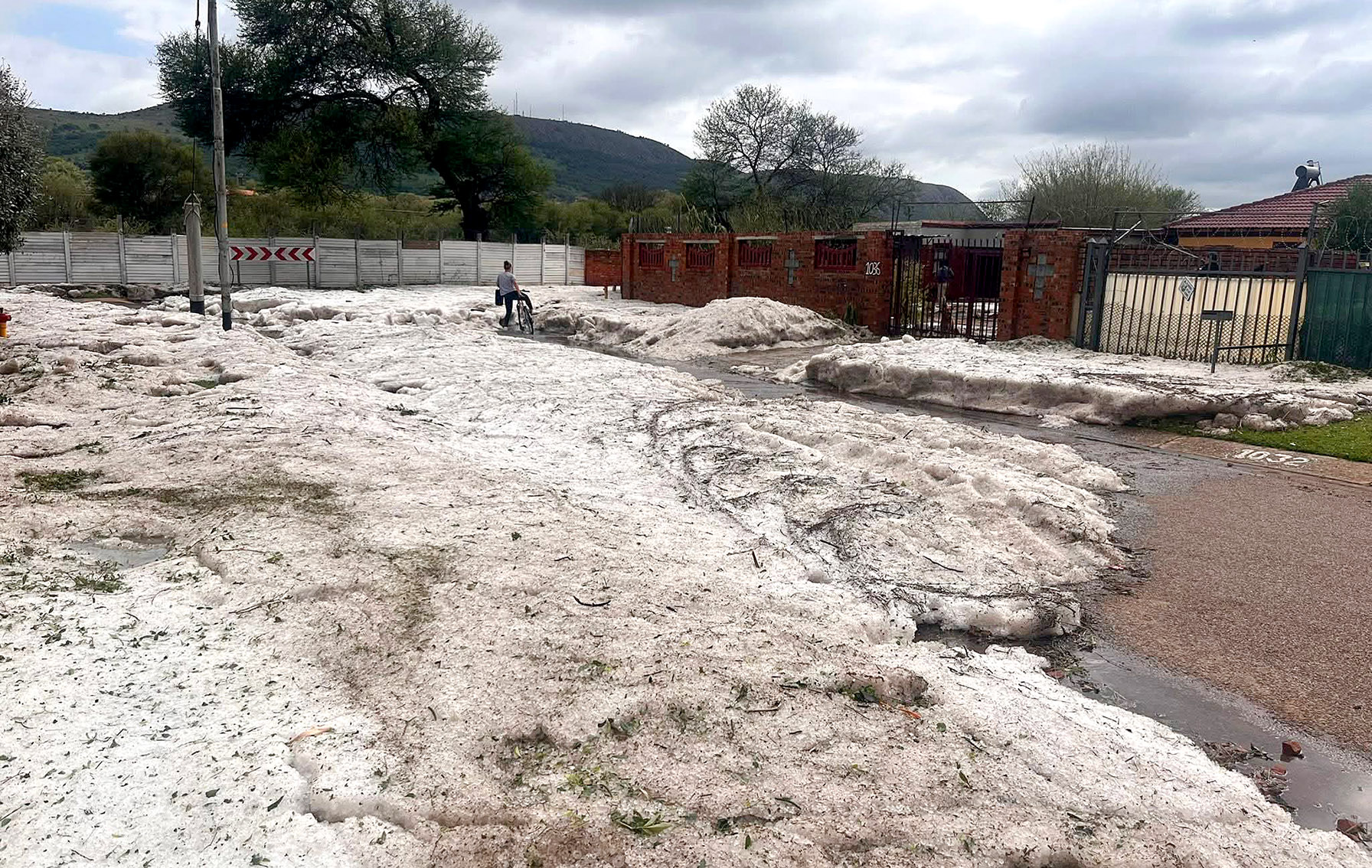
 A hail-strewn street in Daspoort, Pretoria, after Sunday’s storm. (Photo: SA Weather Updates)
 Many South Africans will have to shelve their hopes for a calm and sunny start to summer, as intense thunderstorms are predicted to continue intermittently across much of the country well into the festive season.
This comes after parts of Gauteng, the Free State and KwaZulu-Natal were battered on Sunday night by thunderstorms and severe hailstorms.
Earlier on Sunday, the South African Weather Service (Saws) warned that the intense showers would cause localised flooding and property damage. On Monday morning, residents took stock of the trail of destruction, with many reporting flooded, hail-damaged cars and structures.
/file/attachments/orphans/592651531_2639637036392870_8288806510852519998_n_241275.jpg "The roof of Pretoria resident Chané van Wyk's house collapsed in Sunday’s hailstorm, smashing two vehicles in front of the front door. (Photo: Chané van Wyk / Facebook)")
More thunderstorms and hail ahead
The first week of December is shaping up to be a continuation of the turbulent, storm-soaked pattern that dominated the spring months, with Saws warning of “more of the extreme weather conditions” as the month unfolds.
Saws meteorologist Lehlohonolo Thobela said, “For the first week of December, you’re going to see more isolated to scattered chances of showers and thundershowers. We will still have severe weather warnings, mainly for severe thunderstorms.”
He added that on Monday evening, 1 December, leading into Tuesday, 2 December, there would be minor to significant impacts from severe thunderstorms, with the central and eastern parts of South Africa expected to be the most affected, particularly:
- Gauteng;
- The eastern North West;
- Free State;
- Eastern and central KwaZulu-Natal;
- Southern Limpopo; and
- Mpumalanga.
These regions sit squarely in South Africa’s “summer rainfall belt”, but Thobela noted that the intensity of the storms was far beyond what is typical.
He warned that the risk of localised flooding was particularly high over the week and would persist through the rest of December.
/file/attachments/orphans/594025370_1320482516786520_6002062329757962296_n_103717.jpg "After Sunday night’s storm, hail in Sinoville, Pretoria, was still unmelted on Monday. (Photo: Storm Report SA)")
“Heavy rain leads to flooding, damaging winds may cause localised structure damage as well as the falling of trees. [Expect] large hail, large amounts of small hail and disruptions to traffic due to pooling of water, falling trees and low visibility,” he said.
Low-lying areas, including Gauteng’s East Rand, Pretoria’s flood-prone stretches and numerous river-adjacent zones, tend to be the first that are inundated.
A month of above-normal rainfall
The broader pattern is clear: December will be wetter than usual, with repeated bouts of heavy rain, hail and disruptive storms.
“December as a whole — you can expect showers and thundershowers, heavy rain, localised flooding, as well as the possibility of more hail. With the seasonal forecast still suggesting above-normal rains … most of the rain will come from thunderstorms,” said Thobela.
South Africa has already recorded its wettest October in years, followed by a stormy November, and that momentum is spilling into the final month of 2025.
What’s driving the extreme weather?
The ingredients for severe thunderstorms are simple but potent: heat, moisture, wind shear and a trigger that lifts warm air upward. Right now, South Africa has all of these in excess.
But there is a bigger force at play, too. Global heating is amplifying these storms.
“Global heating actually plays a role in everything. The extreme weather conditions in the eastern parts are definitely linked to global heating. The patterns are still the same, just the frequency is increasing, and it’s much more rapid,” said Thobela
Higher temperatures mean the atmosphere holds more moisture, which in turn fuels more violent thunderstorms.
Staying safe
Thobela urged the public to take weather warnings seriously and to prepare rather than panic.
“Follow the weather service… We have X, Facebook, Instagram and TikTok where we send out forecasts,” he said, adding that residents should seek shelter when thunderstorms approach, move vehicles under cover where possible, and avoid driving through flooded roads.
He stressed that early reporting mattered. Fallen trees, blocked drains and damaged infrastructure should be reported to local authorities immediately.
“It’s always good to be ahead. We push the notion that you need to be proactive,” he said. DM