


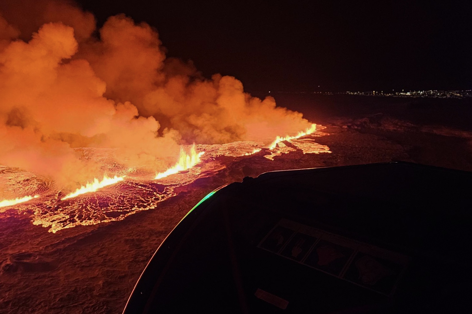
 epa11036649 A handout picture provided by Iceland Civil Defense shows a volcanic eruption north of Grindavik, Iceland, 18 December 2023. The Icelandic Meteorological and Seismological Office (MET) reported late 18 December that a volcano erupted about 4 kilometers northeast of the town of Grindavik. An evacuation order for the population of Grindavik was issued early this year on 10 November 2023 following seismic activity and indications of considerable magma movement in the area. EPA-EFE/Iceland Civil Defense (almannavarnadeild) / HANDOUT HANDOUT EDITORIAL USE ONLY/NO SALES HANDOUT EDITORIAL USE ONLY/NO SALES
 The eruption late on Monday on the Reykjanes peninsula in southwest Iceland spewed lava and smoke more than 100 metres (330 feet) into the air after weeks of intense seismic activity.
"The eruption does not present a threat to life," an Icelandic government statement said.
"There are no disruptions to flights to and from Iceland and international flight corridors remain open."
Authorities last month evacuated the nearly 4,000 inhabitants of the fishing town of Grindavik about 40 km (25 miles) southwest of capital city Reykjavik.
Images and live streaming of the eruption shown by Reuters and others showed bright yellow, orange and red lava in sharp contrast against the night sky.
The eruption opened a 4 km (2.5 mile) fissure from which lava fountains emerged. But at its southernmost point the crack was still 3 km away from Grindavik, Iceland's Meteorological Office said.
"The eruption is taking place north of the watershed, so lava does not flow towards Grindavik," geologist Bjorn Oddson told public broadcaster RUV.
Located between the Eurasian and the North American tectonic plates, among the largest on the planet, Iceland is a seismic and volcanic hot spot because the two plates move in opposite directions.
(Reporting by Louise Rasmussen in Copenhagen, Anna Ringstrom in Stockholm and Terje Solsvik in OsloEditing by David Goodman)