


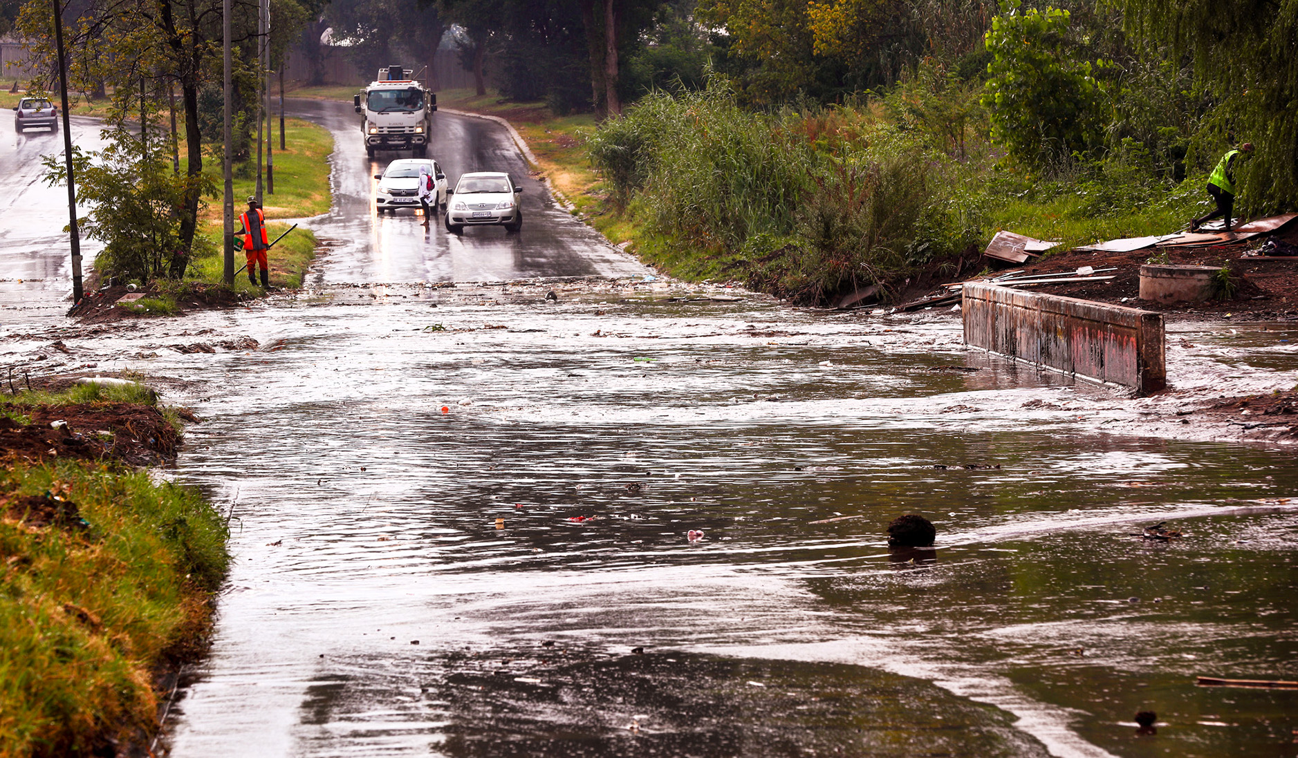
 The bridge along Nancefield Moroka Road in Mofolo South, Soweto, on 2 February 2023 after the area received heavy rain. (Photo: Gallo Images / Fani Mahuntsi)
 The South African Weather Service has warned that a cut-off low-pressure system is expected to develop in parts of the country on Wednesday, 8 February — a weather system notorious for causing severe weather, including heavy rainfall and flooding.
As a result, persistent rainfall may cause widespread flooding over the central, southern and eastern parts of the country.
A similar, but stronger system caused the lethal KZN floods last year and the infamous floods in Laingsburg, Western Cape, in 1981.
The weather service has issued a yellow and orange impact-based severe weather warning for parts of the country, and the KZN floods were a red warning.
Weather service forecaster Wayne Venter told Our Burning Planet that orange level warnings (levels 5-9) are for significant or severe impacts. Level 10, which is what KZN had, is the highest impact possible.
/file/dailymaverick/wp-content/uploads/2023/02/unnamed-2.jpg "(Source: South African Weather Service)")
“We wanted to put out a statement as a heads-up that this is coming and we just need to be prepared,” said Venter.
“Cut-off lows are notorious for flooding and widespread flooding. There are indications of flooding on numerical model predictions, especially over the Eastern Cape… later in the week it probably will move to parts of Mpumalanga and Limpopo… it could even influence parts of KZN.”
Venter said people residing in those areas, particularly in low-lying areas, needed to be prepared for heavy rainfall and flooding.
“If you live near a bridge, don’t drive through 20 centimetres of water, try and avoid crossing low-lying bridges… those common types of knowledge people need to be aware of, they can’t take the risks,” said Venter.
Parts of the Eastern Cape will be affected, extending from Barkly East all the way to Mthatha and Port St Johns, as well as some parts of KZN, the Ugu district, Port Edward and Giants Castle, which can expect 50-80mm of rainfall and flooding of bridges, roads and possibly even settlements.
“You might have rain-on-rain events over those areas, and that’s where the concern comes in,” said Venter, explaining that three to four days of consistent rain are likely to lead to flooding.
“Major rainfall events, especially over the southern half of the country, are usually caused by cut-off lows… we usually get extreme weather from them — we need to be on the lookout for them.”
Technology and forecasters not the issue
After the devastating KZN floods in April last year in which nearly 500 fatalities occurred, many people wondered whether adequate warning systems were in place.
South Africa has world-class forecasters and modelling. The warnings were there, but what isn’t always there is climate hazard literacy — people’s understanding of what to do when these disasters strike.
Read more in Daily Maverick: “Early warning systems on floods are not enough; climate crisis literacy saves lives – experts”
The South African Weather Service, a public entity, is the only mandated regulatory body that can issue weather warnings in the country and provides a three-day rainfall forecast to municipalities every 12 hours.
As a member of the World Meteorological Organization (WMO), a specialised agency of the United Nations, it complies with international meteorological standards.
“We do have to comply to standards that WMO puts out there for us,” said Venter, “and we do have our models on par with them. We do have exceptional scientists.”
Willem Landman, a professor of meteorology at the University of Pretoria, and a specialist in seasonal forecasts, told OBP: “South Africa has very good weather models and very well trained weather forecasters.”
South Africa has a network of radar and weather observation stations across the country.
“You have stations in every town that give you the maximum and minimum temperatures, the dew points, the pressure, the wind direction [and] wind strengths,” said Venter.
The country also has upper-air observations, where balloons are sent up to measure dew points, temperatures and wind strength and speed. The data are then fed into the models that the weather service uses to predict the weather.
Finally, the weather service uses satellite data from Eumetsat — a European satellite company — so it can see what’s happening from space.
“We have world-class warning systems. I think people do not always understand the warnings,” acknowledged Venter.
The problem of load shedding
While South Africa has an excellent observation network, Venter said the big challenge was rolling blackouts, which cause radar on the ground to go offline — and it costs a lot of money to keep the diesel generators running which keep the radars online.
THE STATE OF WEATHER MONITORING IN SOUTH AFRICA BY South African Weather Service - UPDATED TUESDAY 13 DECEMBER 2022
Out of 14 radars owned and operated by the South African Weather Service only 3 (THREE) are currently online and functioning properly. pic.twitter.com/gZppp6tSgC
— Your Weather🌩️by AfriWX (@afriwx) December 13, 2022
He said power surges from the power continually turning on and off result in breakdowns, which is why many of the radars remain offline.
Landman said that when the Irene weather station radar was down because of load shedding, intense thunderstorms were developing that could not be seen.
Events like these have increased due to climate change
The Intergovernmental Panel on Climate Change’s (IPCC’s) Sixth Assessment, published in August 2021, found: “It is indisputable that human activities are causing climate change. Human influence is making extreme climate events, including heatwaves, heavy rainfall and droughts, more frequent and severe.”
Francois Engelbrecht, a professor of climatology and the director of the Global Change Institute at Wits University, told OBP: “Across the world, we are seeing an increase in the number of intense storm systems. This is very well documented.”
The reason is simple: “The warmer we make the atmosphere, the more water vapour it can hold,” explained Engelbrecht, “and therefore there’s more water available for storm systems to eventually cause precipitation.
“The more water vapour in the atmosphere, the greater the potential for intense precipitation events... a direct consequence of a warmer world.
“South Africa is no exception,” said Engelbrecht, who was one of the lead authors of the 2021 IPCC report that also found that across eastern southern Africa, which includes Mozambique and eastern South Africa, there has already been an increase in the number of intense precipitation events.
“This is a direct finding from a statistical analysis of the data that we have from satellites and from weather stations; for the last five decades in the case of the weather stations and for the last four decades in the case of the satellite data,” added Engelbrecht.
The weather service said on Monday that a cut-off low-pressure system was expected to develop over the western interior on Wednesday and move into the central interior where it will become quasi-stationary from Thursday until Saturday before dissipating on Sunday. DM/OBP
Media release 6 Feb 2023: cut-off low to bring widespread showers and flooding to central and eastern South Africa from Wednesday pic.twitter.com/fYP5d2Kv86
— SA Weather Service (@SAWeatherServic) February 6, 2023