TROUBLED WATERS
Is artificial breaching a new chapter or an early sunset for the St Lucia estuary?

With its history of becoming an enormous scrambled egg of interventions with often unpredictable results, the storied estuary has been the centre of one bout of controversy after another. Now, a new commitment to better manage the estuary might prove easier said than done.
River floodplains – by their very name and nature – have a nasty habit of getting flooded or waterlogged.
So there should be no surprise that large areas of farmland slap-bang in the Umfolozi River floodplain have been inundated by large volumes of water and mud over recent years.
If this large natural floodplain and major feeder river of Lake St Lucia had remained unmodified, many of the heated debates of the past century are unlikely to have arisen along the boundaries of the iSimangaliso Wetland Park in KwaZulu-Natal.
But, because floodplains are flat, wet and fertile, they are often magnets to farmers across the world.
This can be a recipe for disaster during the wet season or heavy floods. Yet, in northern KZN, where land remains in short supply for many displaced rural communities, subsistence farmers can’t be too picky about planting their bananas and vegetables in places prone to flooding.
From about 1911, the first commercial sugar farmers also began to occupy and drain parts of the lower Umfolozi swamplands. By 1937, they had taken over nearly 30% of the floodplain and kept expanding to occupy nearly half of it by the 1960s.
Sensibly, some farmers built their homes on high ground, often at quite some distance from their flood-prone fields. To protect crops and to access more of the boggy land, they dug deep canals to drain and divert water flow or they raised earth levees to reduce flood risks.
Gradually, these modifications changed the nature of the river from its long and meandering course (which once slowed down the water and spread out the silt load) into a shorter, straighter canal system with much muddier and faster-flowing water.
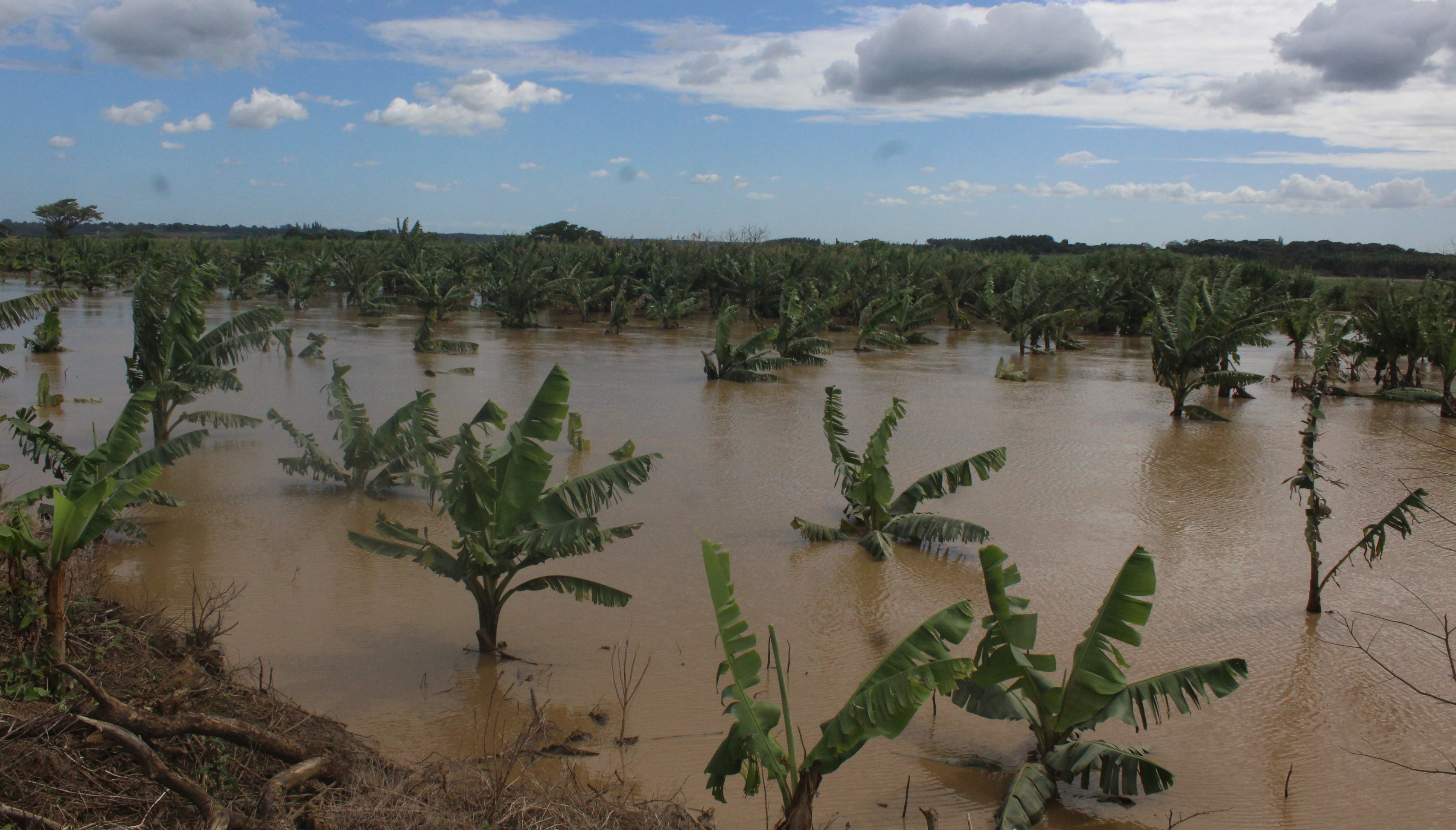
Extensive plantations of banana trees on the banks of the Umfolozi River have been submerged by high water levels. Picture Tony Carnie
By 1948, after a period of prolonged drought, the side-effects of this major land transformation next to Lake St Lucia were becoming increasingly evident. Water entering the lake was often choked with muddy sediments, while some farms were still being flooded from the more frequent closure of the joint mouths of Lake St Lucia and the Umfolozi and Msunduzi rivers.
In 1952, a decision was made to artificially separate the mouth of the Umfolozi from the lake estuary and divert it to flow directly into the sea near the tall coastal dunes of Maphelane.
This suited many farmers, but almost overnight the lake lost nearly 60% of its former water inflow and the estuary mouth began to close up from the sea more often.
One intervention led to another. With less freshwater entering St Lucia, the lake became increasingly salty during dry spells. At times, St Lucia lake water was three times saltier than the ocean and this began to threaten the survival of hippo, crocodiles, fish and other aquatic life. Cyclones and floods also pulverised or demolished some of the concrete and other engineered structures built to keep the mouth open.
In short, it was becoming an enormous scrambled egg of interventions with often unpredictable results.
Finally, in 2002, after decades of human interference, the St Lucia mouth was allowed to close naturally. In 2015, a group of estuarine researchers produced a report funded via the Global Environment Facility (GEF) recommending a new ecologically based restoration plan that included reconnecting the Umfolozi River to the lake.
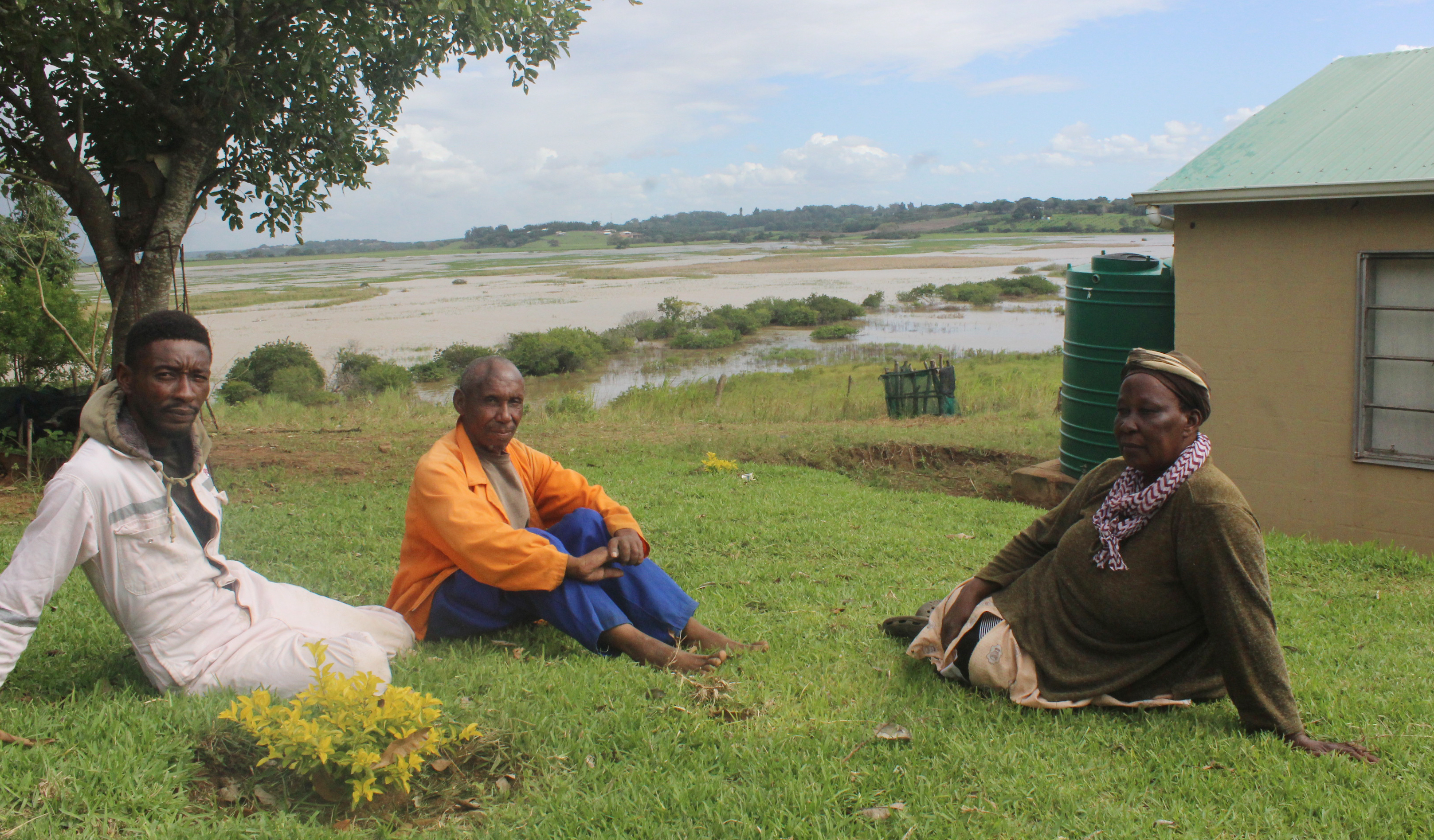
The Shongwe family (from left), Inkosikhona, Joseph and Rasta, used to live in the Mkhuze area but settled at the new Enkanini settlement near Dukuduku forest in 2010. Over recent years, however, their fields of potatoes, onions, cabbage and madumbes have been submerged by the frequent inundation of floodwaters in the Umfolozi River floodplain. (Photo: Tony Carnie)
The sugar farmers, concerned about renewed flood risks, fought back against this plan but lost their case in both the high court and Supreme Court of Appeal.
Soon after the Umfolozi was reconnected to the lake via a new beach channel, fresh criticism emerged from several interest groups who favoured a return to artificial engineering solutions to keep the St Lucia estuary more or less permanently open to the sea.
They included saltwater anglers, tour operators and a large number of subsistence farmers from the Umfolozi floodplain, and the Sokhulu community who farm along the Msunduzi River floodplain.
Following increasing social pressures and a workshop attended by a wide variety of stakeholders, the iSimangaliso Wetland Park authorities hired a private contractor to breach the lake mouth artificially in January 2021 – after a prolonged six-year mouth closure.
But this artificial breaching led to another bout of controversy between those for and against artificial breaching. Forestry, Fisheries and Environment Minister Barbara Creecy appointed a panel of experts to advise whether the breach was conducted legally; the impact and significance of this breaching event and to also develop guidelines for the future management of the lake system.
The five-member panel, chaired by marine biologist Dr Nasreen Peer, presented its 138-page report to Creecy last month and the findings and recommendations were made public at a meeting at St Lucia Eco Lodge on 28 April.
In a nutshell, the panel found that the decision to breach the mouth artificially directly contravened the GEF project recommendations – but that the park authorities had nevertheless acted “within the mandate” of an approved maintenance and management plan, which permitted such breaches in “exceptional circumstances”.
“However, it remains to be proven if (iSimangaliso) complied to its well-outlined legislation and plans.”
The panel also queried whether iSimangaliso managers engaged with the Department of Water Affairs before breaching the mouth. It further questioned the timing of the breach and the lack of scientific monitoring data immediately before and after the event.
While the breaching was justified as an “emergency” intervention, these conditions were not clearly defined. This meant that the park’s management plan – which advocates a policy of minimum human interference in natural processes – was open to interpretation when further artificial breaching was considered.
Significantly, however, the panel has now opened the door for further artificial breaching if there are clearly defined, exceptional reasons to justify this on either ecological or socioeconomic grounds.
The panel also believed there was a major “gap” in park management plans, which failed to take sufficient consideration of social and economic impacts such as flooding of farmland.
This, the panel cautioned, could only exacerbate conflict between park managers and community stakeholders.
To alleviate this conflict, the report recommends that more efforts be made to clear away the dense build-up of reeds and muddy sediment in the Msunduzi River channels that have led to flooding near Sokhulu.
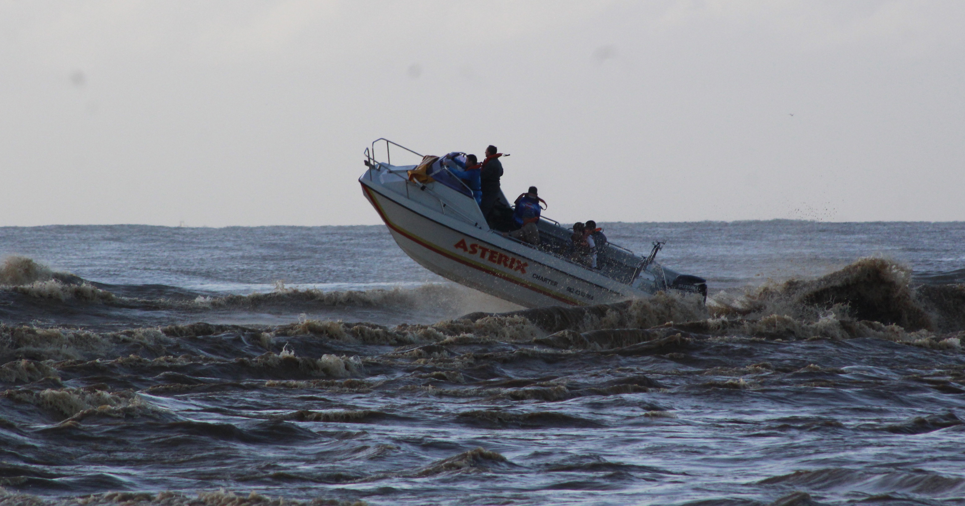
A skiboat crew heads out to sea from the mouth of the Lake St Lucia estuary during the recent Rosebowl deep-sea fishing tournament. (Photo: Tony Carnie)
St Lucia could also no longer be managed in isolation and there was a need to involve several other government authorities (including the national water, agriculture and land affairs departments and municipalities).
Accepting the report, Creecy voiced optimism and said she was committed to guarding the natural heritage of iSimangaliso, while also supporting the livelihoods of communities around the park: “This report has to be the beginning of a new chapter of collaboration and working together in the sustainable management of the St Lucia estuary.”
But opening this brighter new chapter is easier said than done, given the significant levels of conflict that have emerged over management of the mouth.
Subsistence farmers from the Dukuduku, Khula, Zwenelisha, Enkanini and Sokhulu areas have demanded “immediate action” to reduce water levels in the Umfolozi and Msunduzi floodplains. Last month, several hundred local residents – and outsiders – invaded the Futululu forest section of the park in search of new farmlands and housing plots.
Tour operators are also dismayed by the thick accumulations of mud and reed growth near the village of St Lucia that have apparently led to reduced sightings of crocodiles and hippos.
Dukuduku traditional council representative Mjonjani Gumede told Creecy that large numbers of people in the area rely on agriculture to feed their families and they would remain frustrated and angry unless they saw water receding from their flooded fields.
Sokhulu farmers representative Petros Mlaba said his members did not want to read more reports. They wanted action “today”.
“We survive from our fields but now we are overcrowded,” complained Ntokozo Sithole from Dukuduku. “We need space and the minister must not prioritise animals over us.”
Another local community representative told Creecy he was afraid to report back to his people unless he could reassure them and give them hope that water in their fields would drain quickly.
There has also been strong criticism of the current ecological management of the park and the GEF restoration project.
In his submission to the panel, former park ecologist Dr Ricky Taylor said he was concerned that the St Lucia lake system was on the verge of “flipping” irreversibly from an estuary into a shallow freshwater lake – possibly within a decade if the high silt levels entering the lake were not managed urgently.
The effects on sugar farmers, the displacement of people in the Sokhulu area and the flooding of subsistence farms in the Umfolozi floodplain had also not been sufficiently considered by the GEF programme.
“Although I am critical of the GEF management strategy, whenever I was asked my opinion I always responded that we should give it a chance to see if it works or not,” said Taylor.
“My attitude changed radically in September 2020 when I saw the sediment accumulations and associated vegetation responses, learnt about the flooding of the Umfolozi floodplain by backing up of water, and found out that almost no monitoring or assessment to this intervention was being done. There were (in my opinion) irreversible changes occurring and nobody was tracking the effectiveness, or otherwise, of the GEF management strategy.”
In Taylor’s view, it will now become necessary to intervene frequently to maintain St Lucia as a functional estuary – and this should include dredging and artificial breaching based on sound scientific advice.
While it was necessary to “salvage the essentials of the GEF strategy” to relink the Umfolozi to Lake St Lucia, the recent increase in muddy sediment loads had to be reversed, ideally through further international and other forms of funding assistance.
“We cannot implement a management strategy that relies on ‘natural processes’. There has been too much damage to the natural processes in the catchment and Umfolozi flats. We do need human interventions. These must be guided by competent people – who understand the area, have historical background, have experience and have the latest scientific knowledge,” Taylor concluded. DM/OBP
This story first appeared in our weekly Daily Maverick 168 newspaper, which is available countrywide for R25.
[hearken id=”daily-maverick/9419″]







 Become an Insider
The environmental activists like to pretend that St Lucia is a pristine ecosystem. It can’t be. The estuary is part of a much wider anthropocene ecosystem, surrounded by exotic forests, sugar cane, coal mines, a military base as well as typical town and township development, commercial farming and dense former homelands settlements, occupied by tens of thousands of people from the very poor ‘invaders’ of DukuDuku coastal forest to the large and small farmers along the Mfolozi river not to mention the tourists and the people who service them.
The future of the ‘natural’ environment of the lagoon will depend on agreement between all those interests, advised – not dictated to – by aquatic scientists and other environmental scientists. The attempt to claim and impose a particular kind of environment as being’the natural’ is doomed to failure and likely to destroy what could remain a wonderful landscape.
This article needs some serious explanations. The issues with silt and the true nastiness that has transpired as a result of the silt that comes down the Umfolozi river is nowhere to be found. How much true research did the reporters who worked on this article do?
Did your reporters sign up for a paycheck from the iSimangaliso Wetland Park Authority, or perhaps a kick back from the minister of environmental affairs ? It appears that only one side of the story was looked at. the biodiversity losses are not discussed. The economic losses associated with the changed landscape are not discussed. the social impacts of the induced poverty are not discussed.
your article here is very misleading and rather nasty in intent. You are painting a bad picture.
the real nasty problems caused by silt drop out within the water flow zones of the Umfolozi river needs to be explained to the SA public and the rest of the world. The biodiversity of Lake St. Lucia is not discussed. Lake St. Lucia is part of the Umfolozi rivers flood plains due to the direct influences of the 2017 GEF 5 Project.
the scientists involved here, specifically one Nicollette Forbes needs to be questioned. Where do these folks get their info ? why is there zero discussions about the silt ?
the silt has caused real nasty problems as expected. but these problems have been deliberately and with criminal intent, down played and ignored by scientists appointed and paid for by the iSimangaliso Wetland Park Authority